1
River Cynon in Abercynon
This fast flowing Taff tributary flows under the railway arches to join the main river at Watersmeet.
Image: © Colin Smith
Taken: 27 May 2007
0.02 miles
2
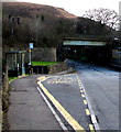
Bus stop, bus shelter and railway bridge, Abercynon
The bridge carries a single-track railway line over the B4275 400 metres NE of Abercynon railway station.
Image: © Jaggery
Taken: 30 Jan 2016
0.02 miles
3
White water on the River Cynon, Abercynon
On February 6th 2019 the Cynon flows vigorously towards its confluence with the larger River Taff.
Image: © Jaggery
Taken: 6 Feb 2019
0.03 miles
4
Leon's Chinese Takeaway, Abercynon
Located at 56 Glancynon Terrace.
One of the signs pointing left shows Stations. This has not been correct since 2008, when Abercynon North railway station closed down and a modified Abercynon South station was renamed Abercynon.
Image: © Jaggery
Taken: 10 Aug 2012
0.03 miles
5
Traffic lights at a sharp bend in the B4275, Abercynon
The lights are dual purpose. Their function is as a pelican crossing (pedestrian controlled lights) and to maintain an alternating flow of one-way traffic on the narrow road under a railway bridge. Viewed in late January 2016.
I was later surprised to see no traffic lights here in an August 2011 Google Earth Street View.
Image: © Jaggery
Taken: 30 Jan 2016
0.04 miles
6
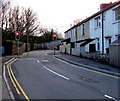
River Row houses, Abercynon
Row of houses extending for 30 metres along the B4275, facing a river, the Afon Cynon.
The small red light on the right is on a pelican crossing control box.
Image: © Jaggery
Taken: 30 Jan 2016
0.04 miles
7
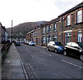
Gwendoline Terrace, Abercynon
Viewed from the corner of the B4275. Gwendoline Terrace leads to Imperial Court.
Image: © Jaggery
Taken: 30 Jan 2016
0.04 miles
8
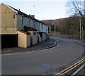
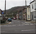
Gwendoline Terrace in Abercynon
Dead-end street on the east bank of the River Cynon viewed across the B4275.
Image: © Jaggery
Taken: 6 Feb 2019
0.04 miles
9
Glimpse of a railway river bridge in Abercynon
The leafless days of winter give the best view from the B4275 of the stone bridge carrying
a railway over the Afon Cynon. The river flows into the River Taff 20 metres behind the bridge.
Image: © Jaggery
Taken: 30 Jan 2016
0.04 miles
10
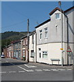
Gwendoline Terrace, Abercynon
Viewed from the corner of Glancynon Terrace.
Image: © Jaggery
Taken: 10 Aug 2012
0.04 miles


