
IMAGES TAKEN NEAR TO
Edward Street, MOUNTAIN ASH, CF45 4RA
Introduction
This page details the photographs taken nearby to Edward Street, CF45 4RA by members of the Geograph project.
The Geograph project started in 2005 with the aim of publishing, organising and preserving representative images for every square kilometre of Great Britain, Ireland and the Isle of Man.

There are currently over 7.5m images from over14,400 individuals and you can help contribute to the project by visiting https://www.geograph.org.uk
Image Map
Images are licensed for reuse under creativecommons.org/licenses/by-sa/2.0
Notes
- Clicking on the map will re-center to the selected point.
- The higher the marker number, the further away the image location is from the centre of the postcode.
Image Listing (223 Images Found)
Images are licensed for reuse under creativecommons.org/licenses/by-sa/2.0
Image
Details
Distance
1
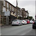
B4275 directions sign alongside Edward Street, Abercynon
Turn left ahead for Mountain Ash (Aberpennar in Welsh).
Turn right ahead for Pontypridd and Merthyr Tydfil.
Image: © Jaggery
Taken: 6 Feb 2019
0.01 miles
2
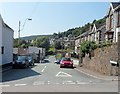
Edward Street, Abercynon
Viewed from Ynysmeurig Road.
Image: © Jaggery
Taken: 10 Aug 2012
0.02 miles
3

Yellow grit bin on an Abercynon corner
On the Mountain Ash Road side of the corner of Ynysmeurig Road.
Image: © Jaggery
Taken: 4 Feb 2019
0.02 miles
4
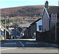
Start of the 20 zone at the top of Ynysmeurig Road, Abercynon
The 30mph speed limit drops to 20mph on the approach to the village school. PARTH is Welsh for ZONE.
Image: © Jaggery
Taken: 4 Feb 2019
0.02 miles
5
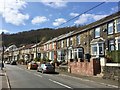
Mountain Ash Road, Abercynon
Housing in Mountain Ash Road, Abercynon.
Image: © Alan Hughes
Taken: 27 Mar 2019
0.03 miles
6
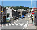
Ynysmeurig Road, Abercynon
Looking up Ynysmeurig Road towards Mountain Ash Road.
The library http://www.geograph.org.uk/photo/3076231 is on the left.
The War Memorial Clock http://www.geograph.org.uk/photo/3076226 is out of shot on the right.
A one-way system is in operation, towards the camera.
Image: © Jaggery
Taken: 10 Aug 2012
0.03 miles
7
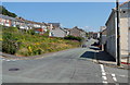
A view NE along Edward Street, Abercynon
Viewed from the corner of Herbert Street, looking towards Ynysmeurig Road.
Image: © Jaggery
Taken: 10 Aug 2012
0.03 miles
8
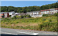
Waste ground, Abercynon
A rectangular area of waste ground measuring 70 metres by 35 metres
separates Edward Street on the camera side from Mountain Ash Road.
Image: © Jaggery
Taken: 10 Aug 2012
0.03 miles
9

Former Moriah church, Abercynon
Above the B4275 Mountain Ash Road viewed from the corner of Ynysmeurig Road in February 2019.
The inscription above the doorway shows the year 1905. https://www.geograph.org.uk/photo/6080810
Image: © Jaggery
Taken: 4 Feb 2019
0.03 miles
10

Moriah 1905 inscription, Abercynon
Faded in 2019, the inscription showing MORIAH ENGLISH BAPTIST CHURCH 1905 is on the wall above the doorway here. https://www.geograph.org.uk/photo/6080808
Image: © Jaggery
Taken: 4 Feb 2019
0.03 miles