IMAGES TAKEN NEAR TO
Cardiff Road, MOUNTAIN ASH, CF45 4PL

Introduction

This page details the photographs taken nearby to Cardiff Road, CF45 4PL by members of the Geograph project.

The Geograph project started in 2005 with the aim of publishing, organising and preserving representative images for every square kilometre of Great Britain, Ireland and the Isle of Man.

There are currently over 7.5m images from over14,400 individuals and you can help contribute to the project by visiting https://www.geograph.org.uk

Image Map


Images are licensed for reuse under creativecommons.org/licenses/by-sa/2.0
Notes
  • Clicking on the map will re-center to the selected point.
  • The higher the marker number, the further away the image location is from the centre of the postcode.

Image Listing (27 Images Found)

Images are licensed for reuse under creativecommons.org/licenses/by-sa/2.0
  • ...
Image
Details
Distance
1
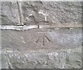
Ordnance Survey Cut Mark
This damaged OS cut mark can be found on No44 Cardiff Street. It marks a point 97.935m above mean sea level.
Image: © Adrian Dust Taken: 27 May 2019
0.03 miles
2
Old railway bridge
Old bridge over the railway near Abercynon.
Image: © Alan Hughes Taken: 27 Mar 2019
0.08 miles
3
Ordnance Survey Cut Mark
This OS cut mark can be found on the south parapet of the railway bridge. It marks a point 86.069m above mean sea level.
Image: © Adrian Dust Taken: 27 May 2019
0.08 miles
4
Carne Park Hotel, Park Street
Image: © Colin Pyle Taken: 31 Aug 2010
0.09 miles
5
The Valleys line
Railway line from Pontypridd up the Rhondda valley, known as the Valleys line.
Image: © Alan Hughes Taken: 27 Mar 2019
0.09 miles
6
Enterprise House, Navigation Park, Abercynon
Enterprise House (Ty Antur in Welsh) is one of several recently-built offices in Navigation Park.
Image: © Jaggery Taken: 10 Aug 2012
0.16 miles
7
Taff Trail following bend in River Taff near Abercynon
Image: © David Smith Taken: 17 Sep 2022
0.17 miles
8
Ordnance Survey Cut Mark
This OS cut mark can be found on No47 Aberdare Road. It marks a point 113.206m above mean sea level.
Image: © Adrian Dust Taken: 27 May 2019
0.18 miles
9
Abercynon Road looking north
Image: © Colin Pyle Taken: 31 Aug 2010
0.19 miles
10
Lon Las Cymru between Cilfynydd and Abercynon
Taken at an access point from Navigation Park.
Image: © John Light Taken: 4 Jan 2013
0.21 miles
  • ...