1
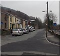
Lower Forest Level, Newtown, Mountain Ash.
View of NE side of the street.
Image: © Michael Oram
Taken: 8 Nov 2007
0.08 miles
2
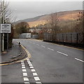
Lower Forest Level, Newtown, Mountain Ash.
View of SW side of the street
Image: © Michael Oram
Taken: 8 Nov 2007
0.09 miles
3
The Afon Cynon in Mountain Ash
Image: © Gareth James
Taken: 24 Feb 2017
0.17 miles
4
Blocked-off SE end of Cardiff Road, Mountain Ash
Viewed from opposite the Cresselly Arms. http://www.geograph.org.uk/photo/3830435
About 100 metres ahead, black posts block the passage of any vehicle wider than a motorbike.
Image: © Jaggery
Taken: 30 Jan 2014
0.17 miles
5
Cardiff Road houses in Mountain Ash
Houses at the SE end of Cardiff Road, viewed from a small (free) car park on a bank of the Afon Cynon.
Image: © Jaggery
Taken: 30 Jan 2014
0.19 miles
6
Mountain Ash boundary sign viewed from Miskin
Viewed from the edge of Bella Mima. http://www.geograph.org.uk/photo/3826168 A railway perimeter fence is on the right.
Image: © Jaggery
Taken: 25 Jan 2014
0.20 miles
7
Downstream along the Afon Cynon, Mountain Ash
Looking SE from this http://www.geograph.org.uk/photo/4093042 bridge. The Cynon is a major tributary
of the River Taff, into which it flows at Abercynon.
Image: © Jaggery
Taken: 30 Jan 2014
0.21 miles
8
Railway compound, Miskin
Looking across the B4275 Miskin Road towards a fenced compound
alongside a railway line, about 250 metres SE of Mountain Ash railway station.
Image: © Jaggery
Taken: 30 Jan 2014
0.21 miles
9
Bella Mima, Miskin
Bella Mima is an Italian American restaurant in Miskin Road, a few metres on the Miskin side of the Mountain Ash boundary.
Image: © Jaggery
Taken: 25 Jan 2014
0.21 miles
10
Miskin boundary sign viewed from Mountain Ash
Looking across Miskin Road towards Bella Mima. http://www.geograph.org.uk/photo/3826168
Image: © Jaggery
Taken: 25 Jan 2014
0.21 miles


