
IMAGES TAKEN NEAR TO
John Street, MOUNTAIN ASH, CF45 4HW
Introduction
This page details the photographs taken nearby to John Street, CF45 4HW by members of the Geograph project.
The Geograph project started in 2005 with the aim of publishing, organising and preserving representative images for every square kilometre of Great Britain, Ireland and the Isle of Man.

There are currently over 7.5m images from over14,400 individuals and you can help contribute to the project by visiting https://www.geograph.org.uk
Image Map
Images are licensed for reuse under creativecommons.org/licenses/by-sa/2.0
Notes
- Clicking on the map will re-center to the selected point.
- The higher the marker number, the further away the image location is from the centre of the postcode.
Image Listing (11 Images Found)
Images are licensed for reuse under creativecommons.org/licenses/by-sa/2.0
Image
Details
Distance
1
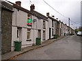
Lower Forest Level, Newtown, Mountain Ash.
View of SW side of the street
Image: © Michael Oram
Taken: 8 Nov 2007
0.06 miles
2
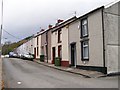
Lower Forest Level, Newtown, Mountain Ash.
View of NE side of the street.
Image: © Michael Oram
Taken: 8 Nov 2007
0.07 miles
3
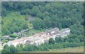
Strand Street, Newtown, Mountain Ash
This is a photo taken of Strand Street after the coal tip was taking away that was behind the houses on the left hand side, the photo was taken from Perthcelyn.
Image: © Rhiannon Wood
Taken: Unknown
0.11 miles
4
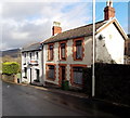
Miskin Cottages, Miskin
Two semi-detached houses at the southern end of Miskin Road, near the B4275 junction.
Image: © Jaggery
Taken: 4 Feb 2014
0.23 miles
5
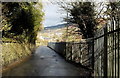
Between wall and fence, Miskin Road, Miskin
This part of Miskin Road has a semi-rural feel. There are no pavements.
Traffic is one way, towards the camera. The fence is a railway perimeter.
Image: © Jaggery
Taken: 4 Feb 2014
0.24 miles
6
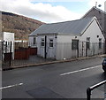
Mountain Ash Christadelphian (Brethren in Christ) church, Miskin
Viewed across Glyngwyn Street, Miskin.
Image: © Jaggery
Taken: 4 Feb 2014
0.24 miles
7
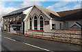
Miskin Methodist Chapel, Miskin
Viewed across Glyngwyn Street. Mojo's hair studio is on the left.
Image: © Jaggery
Taken: 4 Feb 2014
0.24 miles
8
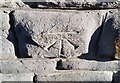
Ordnance Survey Cut Mark
This OS cut mark can be found on No13 Cynon View. It marks a point 118.509m above mean sea level.
Image: © Adrian Dust
Taken: 19 Jan 2018
0.24 miles
9
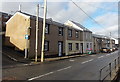
Glyngwyn Street houses, Miskin
Looking NNW from opposite the corner of Mount Pleasant Terrace. http://www.geograph.org.uk/photo/3836652
Image: © Jaggery
Taken: 4 Feb 2014
0.24 miles
10
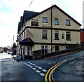
Mount Pleasant Hotel, Miskin
On the corner of Penrhiwceiber Road and Bush Road.
Image: © Jaggery
Taken: 4 Feb 2014
0.25 miles