1
Ordnance Survey Cut Mark
This OS cut mark can be found on the wall of the old Labour Exchange building. It marks a point 110.130m above mean sea level.
Image: © Adrian Dust
Taken: 19 Jan 2018
0.03 miles
2
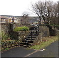
Steps from Cardiff Road to New Road, Mountain Ash
The green board on the Jobcentre Plus http://www.geograph.org.uk/photo/3830529 can be seen centre right.
Image: © Jaggery
Taken: 25 Jan 2014
0.03 miles
3
Jobcentre Plus in Mountain Ash
Viewed across the A4059 New Road.
Image: © Jaggery
Taken: 25 Jan 2014
0.04 miles
4
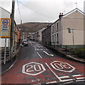
Seymour Street, Mountain Ash
Viewed from the A4059 New Road.
Image: © Jaggery
Taken: 25 Jan 2014
0.04 miles
5
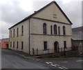
Former Nazareth Church in Mountain Ash
The building in Cardiff Road is now in residential use.
Image: © Jaggery
Taken: 25 Jan 2014
0.04 miles
6
Cardiff Road Surgery, Mountain Ash
The surgery entrance is near the small car park on the left.
Image: © Jaggery
Taken: 25 Jan 2014
0.04 miles
7
Cardiff Road Garage, Mountain Ash
On the corner of Cardiff Road and the A4059.
Image: © Jaggery
Taken: 25 Jan 2014
0.05 miles
8
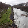
Riverside track in Mountain Ash
The discoloration marks a well-trodden route along a bank of the Afon Cynon.
Image: © Jaggery
Taken: 25 Jan 2014
0.06 miles
9
Time for a break, Mountain Ash ? 1969
The Mountain Ash Railway was a colliery railway, latterly NCB serving a number of locations in the Cynon Valley, and centred on Mountain Ash, The two locomotives are making their way to the locomotive shed for a mid-day break. They are (left) No.8 and (right) Sir John. No.8 had a varied history, starting life as a War Department 'Austerity' locomotive in 1944, having been built in 1944 by Robert Stephenson and Hawthorns of Newcastle. It was sold to the Hunslet Engineering Co of Leeds in 1960 where it was rebuilt incorporating improvements to the designs of Argentinian steam engineer L D Porta. It was given their works number 3880 and sold to the NCB in 1961. After withdrawal it was sold into preservation and after several moves is currently (2020) at the Dean Forest Railway. 'Sir John' was built by Avonside Engineering of Bristol (no.1680) in 1914. It too has survived into preservation and is currently (2020) on long term loan to Pontypool and Blaenavon Railway at Big Pit, Blaenavon.
The tall building behind Sir John is the Mountain Ash Workmen's Club, which still survives. The station platforms in the foreground are those of the closed Mountain Ash (Cardiff Road) station of the former Vale of Neath Railway.
Image: © Alan Murray-Rust
Taken: 27 Nov 1969
0.06 miles
10
Former Bethania chapel, Mountain Ash
On the corner of Phillip Street and Jeffrey Street. The original 1854 chapel was rebuilt in 1859.
Grade II listed in 1999. There was no nameboard here at the early 2014 date of this view.
One source states that the church closed in 2011.
Image: © Jaggery
Taken: 25 Jan 2014
0.06 miles


