1
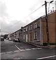
Junction of Miskin Road and Bailey Street, Miskin
Miskin Road from Mountain Ash becomes a one-way street on the left. The houses are in Miskin Terrace.
Image: © Jaggery
Taken: 25 Jan 2014
0.00 miles
2
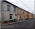
Miskin Terrace, Miskin
Viewed across Bailey Street.
Image: © Jaggery
Taken: 25 Jan 2014
0.01 miles
3
Korai Indian takeaway in Miskin
Located in Bailey Street facing Miskin Terrace.
Image: © Jaggery
Taken: 25 Jan 2014
0.03 miles
4
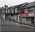
The Beehive Hair Studio and Flames Kebab House in Miskin
The Bailey Street businesses are opposite Glyngwyn Street.
Image: © Jaggery
Taken: 25 Jan 2014
0.04 miles
5
The Beehive Hair Studio, Miskin
Viewed across Bailey Street. The beehive, depicted on the nameboard, is a hairdo made famous in the 1960s by Dusty Springfield. Also in view are Get Set barber shop and Bailey Street Store, a Lifestyle Express shop.
Image: © Jaggery
Taken: 30 Jan 2014
0.04 miles
6
Derelict corner of Miskin Road and Bailey Street, Miskin
I wondered why a derelict building has what looks like a new or newish slate roof.
Image: © Jaggery
Taken: 25 Jan 2014
0.04 miles
7
Between wall and fence, Miskin Road, Miskin
This part of Miskin Road has a semi-rural feel. There are no pavements.
Traffic is one way, towards the camera. The fence is a railway perimeter.
Image: © Jaggery
Taken: 4 Feb 2014
0.04 miles
8
Clas Gwernifor, Mountain Ash
A short cul-de-sac at the southern edge of Mountain Ash, near the Miskin boundary.
Image: © Jaggery
Taken: 25 Jan 2014
0.05 miles
9
Victoria Street houses, Miskin
Houses on the west side of the street, viewed looking towards Bailey Street.
Image: © Jaggery
Taken: 30 Jan 2014
0.05 miles
10
Road from Miskin to Penrhiwceiber
The B4275, here named Glyngwyn Street, heads SE away from Bailey Street.
Image: © Jaggery
Taken: 25 Jan 2014
0.05 miles


