
IMAGES TAKEN NEAR TO
Glanlay Street, MOUNTAIN ASH, CF45 3TN
Introduction
This page details the photographs taken nearby to Glanlay Street, CF45 3TN by members of the Geograph project.
The Geograph project started in 2005 with the aim of publishing, organising and preserving representative images for every square kilometre of Great Britain, Ireland and the Isle of Man.

There are currently over 7.5m images from over14,400 individuals and you can help contribute to the project by visiting https://www.geograph.org.uk
Image Map
Images are licensed for reuse under creativecommons.org/licenses/by-sa/2.0
Notes
- Clicking on the map will re-center to the selected point.
- The higher the marker number, the further away the image location is from the centre of the postcode.
Image Listing (117 Images Found)
Images are licensed for reuse under creativecommons.org/licenses/by-sa/2.0
Image
Details
Distance
1
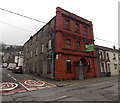
Former Miners Welfare Hall for sale in Penrhiwceiber
The long derelict building is on the corner of the B4275 Rheola Street
and Cynon Terrace, opposite the Osborne Hotel. http://www.geograph.org.uk/photo/3830957
Image: © Jaggery
Taken: 30 Jan 2014
0.03 miles
2
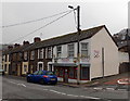
Paula's Pantry, Penrhiwceiber
Takeaway food shop on the corner of Rheola Street and Cross Street.
Image: © Jaggery
Taken: 30 Jan 2014
0.03 miles
3
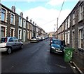
Glanlay Street, Penrhiwceiber
Viewed from Cynon Terrace looking NNW towards Cross Street.
Image: © Jaggery
Taken: 4 Feb 2014
0.04 miles
4
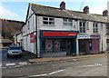
Ladbrokes, Penrhiwceiber
Betting shop at 62 Rheola Street, on the corner of Cross Street.
Also in view are Kath's Barber Shop and Waggy Tailz dog grooming.
Image: © Jaggery
Taken: 4 Feb 2014
0.04 miles
5
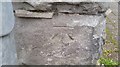
Ordnance Survey Cut Mark
This OS cut mark can be found on No87 Morris Avenue. It marks a point 127.101m above mean sea level.
Image: © Adrian Dust
Taken: 15 Apr 2018
0.05 miles
6
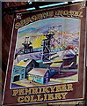
Osborne Hotel name sign, Penrhiwceiber
Near the corner here http://www.geograph.org.uk/photo/3830957 The sign shows the Anglicised spelling Penrikyber.
This was the only example I saw in Penrhiwceiber, so it appears to be an obsolete spelling.
Image: © Jaggery
Taken: 4 Feb 2014
0.05 miles
8
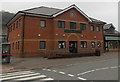
Penrhiwceiber Medical Centre
Viewed across Penrhiwceiber Road from the corner of Cross Street. Sheppards Pharmacy is on the right.
Image: © Jaggery
Taken: 30 Jan 2014
0.05 miles
9

Penrhiwceiber Primary School
This is the southern (Cross Street) side of the school formed in September 2003 from the amalgamation
of Penrhiwceiber Infants School and Penrhiwceiber Junior School, which had existed for more than a century.
Image: © Jaggery
Taken: 4 Feb 2014
0.05 miles
10
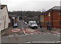
Cross Street, Penrhiwceiber
Viewed across the B4275 which is Penrhiwceiber Road north (right) of Cross Street and Rheola Street on the south side.
Image: © Jaggery
Taken: 30 Jan 2014
0.06 miles