1
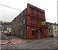
Osborne Hotel, Penrhiwceiber
On the corner of the B4275 Rheola Street and Cynon Terrace.
http://www.geograph.org.uk/photo/3841209 to a view of the hotel name sign.
Image: © Jaggery
Taken: 30 Jan 2014
0.04 miles
2
South along Glanlay Street, Penrhiwceiber
Viewed from Cynon Terrace looking past Happy Valley takeaway.
Image: © Jaggery
Taken: 4 Feb 2014
0.04 miles
3
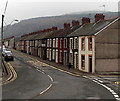
Long row of houses, Rheola Street, Penrhiwceiber
The row extends north for about 110 metres from the corner of Glasbrook Terrace.
Image: © Jaggery
Taken: 30 Jan 2014
0.05 miles
4
Uneven road surface in Penrhiwceiber
Viewed from the corner of Glasbrook Terrace and Rheola Street along an
unnamed road connecting the southern ends of Glanlay Street and Morris Avenue.
Image: © Jaggery
Taken: 30 Jan 2014
0.05 miles
5
Former Miners Welfare Hall for sale in Penrhiwceiber
The long derelict building is on the corner of the B4275 Rheola Street
and Cynon Terrace, opposite the Osborne Hotel. http://www.geograph.org.uk/photo/3830957
Image: © Jaggery
Taken: 30 Jan 2014
0.05 miles
6
Hope & Glory Boxing Club, Penrhiwceiber
Located in the former Hope Methodist Chapel, Rheola Street.
Image: © Jaggery
Taken: 4 Feb 2014
0.05 miles
7
Osborne Hotel name sign, Penrhiwceiber
Near the corner here http://www.geograph.org.uk/photo/3830957 The sign shows the Anglicised spelling Penrikyber.
This was the only example I saw in Penrhiwceiber, so it appears to be an obsolete spelling.
Image: © Jaggery
Taken: 4 Feb 2014
0.05 miles
8
Rheola Street houses, Penrhiwceiber
Viewed from opposite the Osborne Hotel http://www.geograph.org.uk/photo/3830957 looking south along Rheola Street towards Vaughan Terrace.
Image: © Jaggery
Taken: 30 Jan 2014
0.06 miles
9
Southern end of Rheola Street, Penrhiwceiber
Looking north towards the B4275 from the edge of a recreation area on the site of the former Penrhikyber Colliery. http://www.geograph.org.uk/photo/3891286
Image: © Jaggery
Taken: 30 Jan 2014
0.06 miles
10
Change of name along the B4275 in Penrhiwceiber
The B4275 Rheola Street becomes the B4275 Vaughan Terrace ahead.
Rheola Street continues as an unclassified road on the left.
Image: © Jaggery
Taken: 30 Jan 2014
0.07 miles


