1
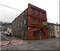
Paula's Pantry, Penrhiwceiber
Takeaway food shop on the corner of Rheola Street and Cross Street.
Image: © Jaggery
Taken: 30 Jan 2014
0.03 miles
2
Ladbrokes, Penrhiwceiber
Betting shop at 62 Rheola Street, on the corner of Cross Street.
Also in view are Kath's Barber Shop and Waggy Tailz dog grooming.
Image: © Jaggery
Taken: 4 Feb 2014
0.03 miles
3
Former Miners Welfare Hall for sale in Penrhiwceiber
The long derelict building is on the corner of the B4275 Rheola Street
and Cynon Terrace, opposite the Osborne Hotel. http://www.geograph.org.uk/photo/3830957
Image: © Jaggery
Taken: 30 Jan 2014
0.04 miles
4
Osborne Hotel name sign, Penrhiwceiber
Near the corner here http://www.geograph.org.uk/photo/3830957 The sign shows the Anglicised spelling Penrikyber.
This was the only example I saw in Penrhiwceiber, so it appears to be an obsolete spelling.
Image: © Jaggery
Taken: 4 Feb 2014
0.04 miles
5
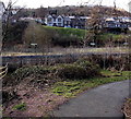
Glasbrook Terrace, Penrhiwceiber
Looking towards Cynon Terrace. The houses face a football ground in the valley of the Afon Cynon.
Image: © Jaggery
Taken: 30 Jan 2014
0.04 miles
6
Children's play area, Penrhiwceiber
Viewed from the corner of Cross Street and Station Terrace.
The War Memorial Clock Tower http://www.geograph.org.uk/photo/3834145 is in the background.
Image: © Jaggery
Taken: 4 Feb 2014
0.05 miles
7
Hope & Glory Boxing Club, Penrhiwceiber
Located in the former Hope Methodist Chapel, Rheola Street.
Image: © Jaggery
Taken: 4 Feb 2014
0.05 miles
8
Station Terrace beyond the railway station, Penrhiwceiber
Viewed from a footpath near this river footbridge http://www.geograph.org.uk/photo/3843454 looking across
Penrhiwceiber railway station http://www.geograph.org.uk/photo/3830935 towards houses in Station Terrace.
Image: © Jaggery
Taken: 4 Feb 2014
0.05 miles
9
The Old Police House, Penrhiwceiber
Viewed from the corner of Cross Street. The year 1905 is inscribed in a tablet high up on the wall.
Some sources show The Old Police House at the northern end of Railway Terrace, others at the southern end of Station Terrace.
Image: © Jaggery
Taken: 4 Feb 2014
0.05 miles
10
Osborne Hotel, Penrhiwceiber
On the corner of the B4275 Rheola Street and Cynon Terrace.
http://www.geograph.org.uk/photo/3841209 to a view of the hotel name sign.
Image: © Jaggery
Taken: 30 Jan 2014
0.05 miles


