1
Road from station to Station Terrace, Penrhiwceiber
The road, about 75 metres long, ascends from Penrhiwceiber railway station http://www.geograph.org.uk/photo/3830935 to Station Terrace.
Image: © Jaggery
Taken: 30 Jan 2014
0.01 miles
2
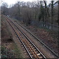
Towards Mountain Ash from Penrhiwceiber
Looking NNW from the footbridge http://www.geograph.org.uk/photo/3831530 at the edge of Penrhiwceiber station
along a single track section of the Aberdare branch of the Merthyr Line.
A river, the Afon Cynon, is behind the fence.
Image: © Jaggery
Taken: 30 Jan 2014
0.02 miles
3
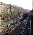
Towards Penrhiwceiber railway station
Viewed from this http://www.geograph.org.uk/photo/3838738 footbridge looking along a single-track section of the Aberdare Branch of the Merthyr Line, between Penrhiwceiber station 300 metres ahead and Mountain Ash station about 1300 metres behind the camera. The river is the Afon Cynon.
Image: © Jaggery
Taken: 4 Feb 2014
0.02 miles
4
Penrhiwceiber Workmens Hall
Viewed across Penrhiwceiber Road. The date on the building is 1888. A notice on the Winifred Street side of the building states that it was "restored at the behest of the Penrhiwceiber Institute Committee for use by the people of Penrhiwceiber and the locality".
Image: © Jaggery
Taken: 4 Feb 2014
0.02 miles
5
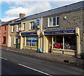
Jaz Convenience Store and post office, Penrhiwceiber
21-23 Penrhiwceiber Road.
Image: © Jaggery
Taken: 4 Feb 2014
0.03 miles
6
Kyber Kebabs, Penrhiwceiber
Takeaway on the corner of Penrhiwceiber Road and Winifred Street.
Penrhiwceiber is usually known locally as Ceiber (pronounced Kyber).
Image: © Jaggery
Taken: 4 Feb 2014
0.03 miles
7
Row of white shops, Penrhiwceiber
Viewed across Penrhiwceiber Road looking towards the corner of Winifred Street.
Image: © Jaggery
Taken: 4 Feb 2014
0.03 miles
8
St Winifred's Church, Penrhiwceiber
St Winifred's Church, Penrhiwceiber in Rhondda Cynon Taf.
Image: © Darren W Rees
Taken: 21 Apr 2000
0.04 miles
9
Penrhiwceiber railway station platform
Nearly 100 metres long, the single platform can comfortably accommodate the Arriva Trains Wales services stopping here on the Aberdare branch of the Merthyr Line, where a train is usually 4 diesel multiple units.
Image: © Jaggery
Taken: 30 Jan 2014
0.04 miles
10
Footbridge at the NW edge of Penrhiwceiber railway station
A wire mesh hood http://www.geograph.org.uk/photo/3831653 covers the footbridge, presumably to prevent miscreants from throwing objects onto trains or track. The right side of the bridge leads to a riverside track, so it is likely that few railway passengers use the footbridge.
It is, however, an excellent location for a general view of the station. http://www.geograph.org.uk/photo/3830935
Image: © Jaggery
Taken: 30 Jan 2014
0.04 miles


