1
Studio 155, Penrhiwceiber
Tattoo studio at 155 Penrhiwceiber Road. The buildings are set slightly below road level.
Image: © Jaggery
Taken: 4 Feb 2014
0.01 miles
2
Penrhiwceiber Road houses, Penrhiwceiber
Located in the NW of the village, near the Miskin boundary.
Image: © Jaggery
Taken: 4 Feb 2014
0.01 miles
3
A.N.A Boxing Club, Penrhiwceiber
Amateur boxing club at 160 Penrhiwceiber Road.
Image: © Jaggery
Taken: 4 Feb 2014
0.02 miles
4
Penrhiwceiber Constitutional Club, Penrhiwceiber
129-133 Penrhiwceiber Road.
Image: © Jaggery
Taken: 4 Feb 2014
0.06 miles
5
Hill View, Penrhiwceiber
Managed by Aelwyd Housing Association Ltd, Hill View is age exclusive housing -
new residents must be at least 55 years old. There are 15 1-bedroom flats.
Located in Penrhiwceiber Road.
Image: © Jaggery
Taken: 4 Feb 2014
0.07 miles
6
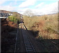
Railway towards Mountain Ash from Penrhiwceiber
Viewed from this http://www.geograph.org.uk/photo/3838738 footbridge looking along a single-track section of the Aberdare Branch of the Merthyr Line, between Penrhiwceiber station 300 metres behind the camera and Mountain Ash station about 1300 metres ahead. Houses in Harcourt Terrace http://www.geograph.org.uk/photo/3838575 are on the left.
Image: © Jaggery
Taken: 4 Feb 2014
0.07 miles
7
Harcourt Terrace, Penrhiwceiber
Viewed from the corner of George Terrace. http://www.geograph.org.uk/photo/3838569
Image: © Jaggery
Taken: 4 Feb 2014
0.07 miles
8
Ordnance Survey Cut Mark
This OS cut mark can be found on No78 Tanycoed Street. It marks a point 141.110m above mean sea level.
Image: © Adrian Dust
Taken: 15 Apr 2018
0.08 miles
9
Hill view, Miskin, Penrhiwceiber
Housing Association residential property for the elderly. http://www.aelwyd.co.uk/properties/property-list/hill-view/
Image: © Alan Hughes
Taken: 27 Mar 2019
0.08 miles
10
Ordnance Survey Cut Mark
This OS cut mark can be found on the wall of No79 Woodfield Terrace. It marks a point 126.309m above mean sea level.
Image: © Adrian Dust
Taken: 15 Apr 2018
0.08 miles


