
IMAGES TAKEN NEAR TO
Cadwaladr Street, MOUNTAIN ASH, CF45 3RD
Introduction
This page details the photographs taken nearby to Cadwaladr Street, CF45 3RD by members of the Geograph project.
The Geograph project started in 2005 with the aim of publishing, organising and preserving representative images for every square kilometre of Great Britain, Ireland and the Isle of Man.

There are currently over 7.5m images from over14,400 individuals and you can help contribute to the project by visiting https://www.geograph.org.uk
Image Map
Images are licensed for reuse under creativecommons.org/licenses/by-sa/2.0
Notes
- Clicking on the map will re-center to the selected point.
- The higher the marker number, the further away the image location is from the centre of the postcode.
Image Listing (42 Images Found)
Images are licensed for reuse under creativecommons.org/licenses/by-sa/2.0
Image
Details
Distance
1
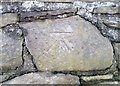
Ordnance Survey Cut Mark
This OS cut mark can be found on the wall SE side of the road. It marks a point 128.479m above mean sea level.
Image: © Adrian Dust
Taken: 19 Jan 2018
0.07 miles
2
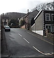
Harcourt Road, Mountain Ash
Viewed across Aberdare Road.
Image: © Jaggery
Taken: 19 Feb 2014
0.08 miles
3
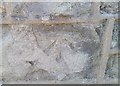
Ordnance Survey Cut Mark
This OS cut mark can be found on No51 Woodland Street. It marks a point 128.126m above mean sea level.
Image: © Adrian Dust
Taken: 19 Jan 2018
0.09 miles
4
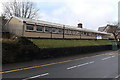
Darran Las Community Building, Mountain Ash
45 metre (nearly 150 ft) long building viewed across the B4275 Aberdare Road.
Image: © Jaggery
Taken: 19 Feb 2014
0.11 miles
5
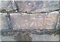
Ordnance Survey Cut Mark
This OS cut mark can be found on the wall SW side of Aberdare Road. It marks a point 117.040m above mean sea level.
Image: © Adrian Dust
Taken: 19 Jan 2018
0.12 miles
6
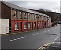
Aberdare Road houses, Mountain Ash
Viewed from the corner of Harcourt Road.
Image: © Jaggery
Taken: 19 Feb 2014
0.12 miles
8
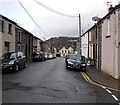
Duffryn Street NW of Union Street, Mountain Ash
Looking towards the Mountain Ash Inn. http://www.geograph.org.uk/photo/3854350
Image: © Jaggery
Taken: 19 Feb 2014
0.15 miles
9
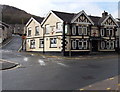
Mountain Ash Inn, Mountain Ash
On the corner of Commercial Street and Fountain Street.
Image: © Jaggery
Taken: 19 Feb 2014
0.15 miles
10
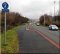
Cynon Trail marker, Mountain Ash
This part of the Cynon Trail footpath and cycle route is alongside the A4059 New Road.
Image: © Jaggery
Taken: 25 Jan 2014
0.17 miles