1
Ordnance Survey Cut Mark
This OS cut mark can be found on No16 Ceridwen Street. It marks a point 174.486m above mean sea level.
Image: © Adrian Dust
Taken: 19 Jan 2018
0.01 miles
2
Ordnance Survey Cut Mark
This OS cut mark can be found on the gatepost of the school. It marks a point 156.146m above mean sea level.
Image: © Adrian Dust
Taken: 19 Jan 2018
0.07 miles
3
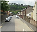
Kingcraft Street, Mountain Ash
One of many steep streets in Mountain Ash, Kingcraft Street climbs away from Llanwonno Road towards the hill in the distance, Graig Darren-las.
Image: © Jaggery
Taken: 26 May 2010
0.08 miles
4
Llanwonno Road, Mountain Ash
Image: © Roger Cornfoot
Taken: 14 Mar 2009
0.09 miles
5
The Royal Oak Inn, Llanwonno Road, Mountain Ash
Image: © Roger Cornfoot
Taken: 14 Mar 2009
0.10 miles
6
Darranlas Post Office, Mountain Ash
Post Office and stores/off-licence located at 113 High Street, viewed from the corner of Darran Road. Until recently, the post office was on the other side of High Street, almost directly opposite, at 118.
Image: © Jaggery
Taken: 26 May 2010
0.13 miles
7
Ordnance Survey Cut Mark
This OS cut mark can be found on No24 Rock Street. It marks a point 156.597m above mean sea level.
Image: © Adrian Dust
Taken: 19 Jan 2018
0.14 miles
8
Western end of York Street, Miskin
York Street ends at the edge of trees ahead. There may be a track through the trees to Llanwonno Road, but I did not explore that possibility.
Image: © Jaggery
Taken: 25 Jan 2014
0.17 miles
9
20mph speed limit along Bryn Ifor, Miskin
Viewed across Bailey Street from the corner of Clarence Street.
Image: © Jaggery
Taken: 25 Jan 2014
0.17 miles
10
High Street, Mountain Ash
Image: © Roger Cornfoot
Taken: 14 Mar 2009
0.17 miles


