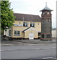
IMAGES TAKEN NEAR TO
High Street, ABERDARE, CF44 9SL

Introduction

This page details the photographs taken nearby to High Street, CF44 9SL by members of the Geograph project.

The Geograph project started in 2005 with the aim of publishing, organising and preserving representative images for every square kilometre of Great Britain, Ireland and the Isle of Man.

There are currently over 7.5m images from over14,400 individuals and you can help contribute to the project by visiting https://www.geograph.org.uk

Image Map


Images are licensed for reuse under creativecommons.org/licenses/by-sa/2.0
Notes
  • Clicking on the map will re-center to the selected point.
  • The higher the marker number, the further away the image location is from the centre of the postcode.

Image Listing (30 Images Found)

Images are licensed for reuse under creativecommons.org/licenses/by-sa/2.0
  • ...
Image
Details
Distance
1
Hirwaun War Memorial
Located on the north side of High Street, adjacent to Hirwaun RFC headquarters and social club.
Image: © Jaggery Taken: 7 May 2010
0.04 miles
2
Hirwaun Post Office
Located on the corner of High Street and Station Road.
Image: © Jaggery Taken: 7 May 2010
0.04 miles
3
Hirwaun Stores
Image: © Roger Cornfoot Taken: 26 Feb 2022
0.05 miles
4
Hirwaun
Y Stryd Fawr yn cwrdd a Heol Aberhonddu ac yn y pellter mae Tafarn y Lamb. High Street joining Brecon Road and the pub in the distance is the Lamb Inn.
Image: © Alan Richards Taken: 24 Jun 2016
0.05 miles
5
War Memorial Tower, Hirwaun
The War Memorial Tower in Hirwaun with the Cardiff Arms pub behind.
Image: © David Gentle Taken: 14 Sep 2007
0.05 miles
6
Hirwaun, clock tower
Clock tower and war memorial on High Street, commemorating 40 fallen in WWI and 27 in WWII.
Image: © Mike Faherty Taken: 11 Jul 2016
0.05 miles
7
Hirwaun War Memorial on Remembrance Sunday 2007
Hirwaun War Memorial on Remembrance Sunday 2007.
Image: © Darren W Rees Taken: 11 Nov 2007
0.06 miles
8
Hirwaun War Memorial
Image: © Peter Robinson Taken: 20 Jul 2012
0.09 miles
9
Ordnance Survey Flush Bracket (S1280)
This OS Flush Bracket can be found on the west angle of St Lleurwg's Church. It marks a point 189.629m above mean sea level.
Image: © Adrian Dust Taken: 12 May 2017
0.09 miles
10
Ordnance Survey Cut Mark
This OS cut mark can be found on the SW face of St Lleurwg's Church. It marks a point 189.847m above mean sea level.
Image: © Adrian Dust Taken: 12 May 2017
0.09 miles
  • ...