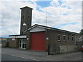
IMAGES TAKEN NEAR TO
Ivy Cottages, ABERDARE, CF44 9QF
Introduction
This page details the photographs taken nearby to Ivy Cottages, CF44 9QF by members of the Geograph project.
The Geograph project started in 2005 with the aim of publishing, organising and preserving representative images for every square kilometre of Great Britain, Ireland and the Isle of Man.

There are currently over 7.5m images from over14,400 individuals and you can help contribute to the project by visiting https://www.geograph.org.uk
Image Map
Images are licensed for reuse under creativecommons.org/licenses/by-sa/2.0
Notes
- Clicking on the map will re-center to the selected point.
- The higher the marker number, the further away the image location is from the centre of the postcode.
Image Listing (19 Images Found)
Images are licensed for reuse under creativecommons.org/licenses/by-sa/2.0
Image
Details
Distance
1
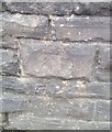
Ordnance Survey Cut Mark
This OS cut mark can be found on the wall SW side of Brecon Road. It marks a point 195.587m above mean sea level.
Image: © Adrian Dust
Taken: 13 Aug 2020
0.10 miles
2
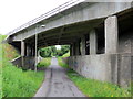
O dan yr A465 / Under the A465
Llwybr Cyhoeddus a llwybr seiclo yn mynd o dan yr A465 (Heol Blaenau'r Cymoedd).
A public footpath and a cycle path going under the A465 (Heads of the Valleys Roads).
Image: © Alan Richards
Taken: 24 Jun 2016
0.10 miles
4
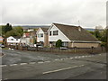
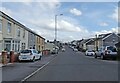
Cae Felin Parc, Hirwaun
Houses on the west side of the road, viewed from the corner of Swansea Road.
Image: © Jaggery
Taken: 7 May 2010
0.16 miles
5
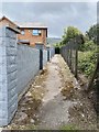
Public footpath
A public footpath passes between an old fence and a concrete wall at Hirwaun.
Image: © Alan Hughes
Taken: 24 Jul 2020
0.16 miles
6
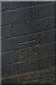
Ordnance Survey Cut Mark
This OS cut mark can be found on No54 The Nant. It marks a point 185.011m above mean sea level.
Image: © Adrian Dust
Taken: 13 Aug 2020
0.18 miles
7
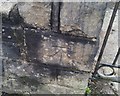
Ordnance Survey Cut Mark
This OS cut mark can be found on the wall of No11 Brecon Road. It marks a point 194.423m above mean sea level.
Image: © Adrian Dust
Taken: 13 Aug 2020
0.18 miles
8
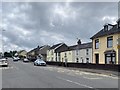
Brecon Road
Housing in Brecon Road, Hirwaun.
Image: © Alan Hughes
Taken: 24 Jul 2020
0.19 miles
9
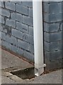
Ordnance Survey Cut Mark
This OS cut mark can be found on No 29 The Nant. It marks a point 188.138m above mean sea level.
Image: © Adrian Dust
Taken: 13 Aug 2020
0.19 miles