IMAGES TAKEN NEAR TO
Longmeadow, ABERDARE, CF44 9QD

Introduction

This page details the photographs taken nearby to Longmeadow, CF44 9QD by members of the Geograph project.

The Geograph project started in 2005 with the aim of publishing, organising and preserving representative images for every square kilometre of Great Britain, Ireland and the Isle of Man.

There are currently over 7.5m images from over14,400 individuals and you can help contribute to the project by visiting https://www.geograph.org.uk

Image Map


Images are licensed for reuse under creativecommons.org/licenses/by-sa/2.0
Notes
  • Clicking on the map will re-center to the selected point.
  • The higher the marker number, the further away the image location is from the centre of the postcode.

Image Listing (18 Images Found)

Images are licensed for reuse under creativecommons.org/licenses/by-sa/2.0
Image
Details
Distance
1
Hirwaun Telephone Exchange
Situated in Rhigos Road, this TE is of a standard design dating from the 1970s and has the code SWHJL. It provides telephone and broadband services to 3,876 residential and 120 non-residential premises in Hirwaun plus Penderyn, Penywaun and Rhigos nearby. Two Openreach vehicles can be seen parked in front of this building. The numbering range of this TE is (01685) 81xxxx, the (01685) referring to the Merthyr Tydfil of four TEs, and its postcode is CF44 9PS.
Image: © David Hillas Taken: 23 Apr 2019
0.01 miles
2
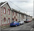
Rhigos Road, Hirwaun
Image: © Roger Cornfoot Taken: 26 Feb 2022
0.07 miles
3
Large workshop doors in Hirwaun
Image: © Gareth James Taken: 7 Oct 2018
0.09 miles
4
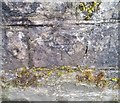
Ordnance Survey Cut Mark
This OS cut mark can be found on the SW parapet of the bridge. It marks a point 189.820m above mean sea level.
Image: © Adrian Dust Taken: 13 Aug 2020
0.11 miles
5
A465 west of Hirwaun
Image: © Colin Pyle Taken: 17 Dec 2013
0.13 miles
6
Hirwaun War Memorial on Remembrance Sunday 2007
Hirwaun War Memorial on Remembrance Sunday 2007.
Image: © Darren W Rees Taken: 11 Nov 2007
0.14 miles
7
Hirwaun
Y Stryd Fawr yn cwrdd a Heol Aberhonddu ac yn y pellter mae Tafarn y Lamb. High Street joining Brecon Road and the pub in the distance is the Lamb Inn.
Image: © Alan Richards Taken: 24 Jun 2016
0.14 miles
8
Hirwaun Stores
Image: © Roger Cornfoot Taken: 26 Feb 2022
0.15 miles
9
Manchester Place, Hirwaun
Image: © Jaggery Taken: 7 May 2010
0.16 miles
10
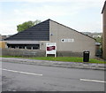
Hirwaun Library
Located on High Street, part of Rhondda Cynon Taf's library service. The building dates from 1972.
Image: © Jaggery Taken: 7 May 2010
0.20 miles