1
Tafarn Llew Coch
The Red Lion Inn, Penderyn.
Image: © Alan Hughes
Taken: 25 Jan 2021
0.00 miles
2
Tafarn Llew Coch
The Red Lion Inn, Penderyn.
Image: © Alan Hughes
Taken: 25 Jan 2021
0.01 miles
3
Ordnance Survey Cut Mark
This OS cut mark can be found on the HE angle of St Cynog's Church. It marks a point 298.850m above mean sea level.
Image: © Adrian Dust
Taken: 8 Jun 2014
0.03 miles
4
Old Direction sign - Signpost by Church Road, Penderyn Parish
Annulus finial - 3 arms; Brecon halo by the UC road, in parish of Penderyn (Brecknockshire District), Penderyn, junction of UC road with Church Road, Beside churchyard gate.
Surveyed
Milestone Society National ID: BRE_SN9408B
Image: © Milestone Society
Taken: Unknown
0.03 miles
5
Ordnance Survey Cut Mark
This OS cut mark can be found on the wall of the rectory at the road junction. It marks a point 292.306m above mean sea level.
Image: © Adrian Dust
Taken: 19 Jul 2020
0.03 miles
6
Old signpost
An old signpost at a road junction near St Cynog’s Church, Penderyn.
Image: © Alan Hughes
Taken: 25 Jan 2021
0.03 miles
7
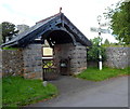
Lych gate and old Brecon County signpost, Penderyn
The lych gate is at the Church Road entrance to Grade II listed St Cynog's Church. http://www.geograph.org.uk/photo/3060073 The lych gate was formerly used to shelter a coffin until the clergyman's arrival for the burial, or pre-burial service.
Some sources state that the church is in Hirwaun, but the old signpost shows that Hirwaun is 2¼ miles away. The signpost is a survivor from the time of the administrative county of Brecon (or Brecknock), abolished in 1974 by the Local Government Act 1972. Most of the former county is now in Powys, but Penderyn is part of Rhondda Cynon Taf.
Image: © Jaggery
Taken: 29 Jul 2012
0.03 miles
8
St Cynog's Church, Penderyn
St Cynog's Church, Penderyn, taken in the Winter of 2006
Image: © crlewis
Taken: Unknown
0.03 miles
9
Signpost & St Cynog Church, Penderyn
Image: © Colin Park
Taken: 15 Jul 2013
0.03 miles
10
St Cynog?s Church, Penderyn
View across a snowy churchyard towards the village church of St Cynog.
Image: © Alan Hughes
Taken: 25 Jan 2021
0.03 miles


