IMAGES TAKEN NEAR TO
Ystradfellte, ABERDARE, CF44 9JE
Introduction
This page details the photographs taken nearby to CF44 9JE by members of the Geograph project.
The Geograph project started in 2005 with the aim of publishing, organising and preserving representative images for every square kilometre of Great Britain, Ireland and the Isle of Man.

There are currently over 7.5m images from over14,400 individuals and you can help contribute to the project by visiting https://www.geograph.org.uk
Image Map
Images are licensed for reuse under creativecommons.org/licenses/by-sa/2.0
Notes
- Clicking on the map will re-center to the selected point.
- The higher the marker number, the further away the image location is from the centre of the postcode.
Image Listing (13 Images Found)
Images are licensed for reuse under creativecommons.org/licenses/by-sa/2.0
Image
Details
Distance
1
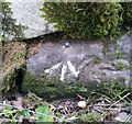
Ordnance Survey Rivet
This OS rivet can be found on the wall east side of the road. It marks a point 370.338m above mean sea level.
Image: © Adrian Dust
Taken: 21 Jul 2020
0.11 miles
2
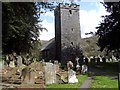
St Mary's Church, Ystradfellte
The Church building dates from the 16th Century but some parts are possibly from an earlier period.
Image: © Robert Davies
Taken: 2 May 2008
0.16 miles
3
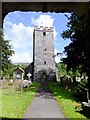
Through the lytchgate: St Mary's Church
Parts of the building are dated to the late twelfth century - built by Cistercian monks. The building stones are thought to have come from a quarry at Plas-y-gors just up the Mellte valley.
Image: © Alan Bowring
Taken: 4 Aug 2014
0.17 miles
4
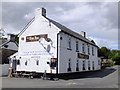
The New Inn - now with new management
As far as I can make out the eastern front of the village pub is just east of the easting line, by a matter of metres. There are more 'New Inns' than any other pub name but each one is unique of course. This one in Wales' 'Waterfall Country' is in prime walking country and should prosper.
Image: © Alan Bowring
Taken: 4 Aug 2014
0.17 miles
5
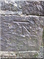
Ordnance Survey Cut Mark
This OS cut mark can be found on the west face of the tower of St Mary's Church. It marks a point 159.3m above mean sea level
Image: © Adrian Dust
Taken: 7 Feb 2016
0.17 miles
6
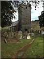
St Mary's Church, Ystradfellte
In the parish of Penderyn Mellte, the church of St Mary, Ystradfellte.
Image: © Alan Hughes
Taken: 25 Mar 2016
0.17 miles
7
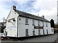
The New Inn, Ystradfellte
The New Inn, Ystradfellte - 'under new management'.
Image: © Alan Hughes
Taken: 25 Mar 2016
0.18 miles
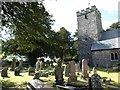
9
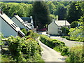
Ystradfellte Village
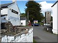
Looking down the hill from the west towards the New Inn and church.
Image: © George Tod
Taken: 10 Jun 2005
0.19 miles