IMAGES TAKEN NEAR TO
Hirwaun Road, ABERDARE, CF44 9AF

Introduction

This page details the photographs taken nearby to Hirwaun Road, CF44 9AF by members of the Geograph project.

The Geograph project started in 2005 with the aim of publishing, organising and preserving representative images for every square kilometre of Great Britain, Ireland and the Isle of Man.

There are currently over 7.5m images from over14,400 individuals and you can help contribute to the project by visiting https://www.geograph.org.uk

Image Map


Images are licensed for reuse under creativecommons.org/licenses/by-sa/2.0
Notes
  • Clicking on the map will re-center to the selected point.
  • The higher the marker number, the further away the image location is from the centre of the postcode.

Image Listing (23 Images Found)

Images are licensed for reuse under creativecommons.org/licenses/by-sa/2.0
  • ...
Image
Details
Distance
1
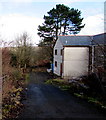
Hebron Piano School, Aberdare
Viewed across Hirwaun Road.
Image: © Jaggery Taken: 31 Jan 2015
0.03 miles
2
Penywaun cemetery
A very large cemetery off the B4275 in the south of the square.
Image: © Graham Horn Taken: 4 Oct 2008
0.04 miles
3
Penywaun cemetery
Another view of the very large cemetery off the B4275 in the south of the square. Compare with Image]
Image: © Graham Horn Taken: 4 Oct 2008
0.05 miles
4
Dawkins Place, Aberdare
On the north side of the B4275, near the SW corner of Aberdare Cemetery.
Image: © Jaggery Taken: 31 Jan 2015
0.07 miles
5
Entrance to Pleasant View Park, Aberdare
From Hirwaun Road into an area of park homes. A park home is a detached bungalow-style house, usually in a private estate, as here, located on plots known as pitches. Legally, they are mobile homes and are covered by their own legislation.
Image: © Jaggery Taken: 31 Jan 2015
0.08 miles
6
A4059 at Hirwaun Road roundabout
Image: © Colin Pyle Taken: 3 Aug 2018
0.08 miles
7
Aberdare Cemetery
Viewed from near the Hirwaun Road entrance.
Image: © Jaggery Taken: 31 Jan 2015
0.11 miles
8
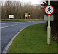
Apparently contradictory signs alongside the A4059 in Aberdare
Viewed from the edge of the B4275 junction, where the red-edged circular sign indicates no pedestrians, yet a yellow sign ahead on the left shows Pedestrians crossing. The explanation is that pedestrians can walk across the A4059 ahead between two ends of a footpath (a public right of way?). Red-edged no pedestrians signs are also at the crossing, indicating that the only route for walkers is across the busy A road (the Aberdare Bypass), not along its edge.
Image: © Jaggery Taken: 31 Jan 2015
0.11 miles
9
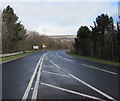
Aberdare Bypass
The A4059 viewed from the B4275 junction.
Image: © Jaggery Taken: 31 Jan 2015
0.12 miles
10
A4059, Hirwaun Road
Looking east towards the roundabout at the western end of the Aberdare bypass.
Image: © Jonathan Billinger Taken: 22 Aug 2013
0.12 miles
  • ...