1
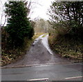
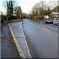
Brynderwen Villas, Aberdare
Viewed across the B4275 Hirwaun Road.
Image: © Jaggery
Taken: 31 Jan 2015
0.00 miles
2
Access road to Greenhill Cottage, Aberdare
From the B4275 Hirwaun Road.
Image: © Jaggery
Taken: 31 Jan 2015
0.03 miles
3
SE entrance to Aberdare Cemetery
From Hirwaun Road. This looks like a disused entrance. The road gates are padlocked at 11am on a Saturday.
I couldn't open the side gate. Located about 200 metres to the NW, this http://www.geograph.org.uk/photo/4331287 entrance was open.
Image: © Jaggery
Taken: 31 Jan 2015
0.05 miles
4
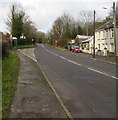
Road from Aberdare towards Penywaun and Hirwaun
Looking to the NW along the B4275 Hirwaun Road from the corner of Cwmdare Road.
A nearby sign https://www.geograph.org.uk/photo/6093715 shows 1 mile to Penywaun, 2½ to Hirwaun.
Image: © Jaggery
Taken: 11 Feb 2019
0.06 miles
5
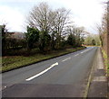
White arrow on Hirwaun Road, Aberdare
Directing traffic to the left side of the B4275 Hirwaun Road.
Image: © Jaggery
Taken: 11 Feb 2019
0.06 miles
6
From 30mph to 40mph along Hirwaun Road, Aberdare
About 2km NW of Aberdare town centre, the speed limit along the B4275 increases to 40mph.
Image: © Jaggery
Taken: 31 Jan 2015
0.07 miles
7
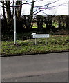
Heol Hirwaun/Hirwaun Road name sign, Aberdare
Viewed in February 2019. The Welsh/English name sign has replaced
the English-only sign seen on the left here https://www.geograph.org.uk/photo/4331284 in 2015.
Image: © Jaggery
Taken: 11 Feb 2019
0.07 miles
8
Aberdare College bus stop and shelter
This stop alongside the B4275 Hirwaun Road is for buses to Hirwaun and Merthyr Tydfil.
A Stagecoach bus from Hirwaun is in the background.
Image: © Jaggery
Taken: 11 Feb 2019
0.08 miles
9
Station Place, Aberdare
Short row of houses viewed across the B4275 Hirwaun Road. Viewed at the end of January 2015
when the nearest railway station to Station Place is the Aberdare terminus about 2km to the SE.
Image: © Jaggery
Taken: 31 Jan 2015
0.09 miles
10
Station Place bus stop, Aberdare
Alongside the B4275 Hirwaun Road, opposite Station Place houses, http://www.geograph.org.uk/photo/4331281 this stop
is for buses towards Penywaun, Hirwaun, Penderyn, Glynneath and Merthyr Tydfil.
Image: © Jaggery
Taken: 31 Jan 2015
0.09 miles


