1
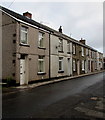
Bwllfa Road, Cwmdare
Miner's cottages with Mynydd Bwllfa beyond.
Image: © Jonathan Billinger
Taken: 22 Aug 2013
0.00 miles
2
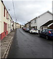
Row of houses in Cwmdare
On the north side of Bwllfa Road. Ahead for the centre of the village.
Image: © Jaggery
Taken: 11 Feb 2019
0.01 miles
3
Ordnance Survey Rivet
This OS rivet can be found on the wall of the Chapel. It marks a point 224.754m above mean sea level.
Image: © Adrian Dust
Taken: 26 Aug 2019
0.02 miles
4
Welsh inscription, Elim, Cwmdare
The tablet on the wall here https://www.geograph.org.uk/photo/6058209 records that Elim Independent Chapel was built in 1859, rebuilt in 1902.
Image: © Jaggery
Taken: 11 Feb 2019
0.02 miles
5
Elim, Bwllfa Road, Cwmdare
The Welsh inscription https://www.geograph.org.uk/photo/6058210 on the building records that Elim Independent Chapel was built in 1859, rebuilt in 1902.
Image: © Jaggery
Taken: 11 Feb 2019
0.02 miles
6
Modern houses, Bwllfa Road, Cwmdare
These houses were built many decades after nearby houses, such as these https://www.geograph.org.uk/photo/6093669 near the camera.
Image: © Jaggery
Taken: 11 Feb 2019
0.03 miles
7
Elim Chapel, Bwllfa Road, Cwmdare
Elim (Welsh Congregationalist) Chapel on Bwllfa Road, Cwmdare.
Image: © Darren W Rees
Taken: 24 Jul 2008
0.03 miles
8
Brick house, Bwllfa Road, Cwmdare
One of several modern houses on the north side of Bwllfa Road between rows of houses many decades older.
Image: © Jaggery
Taken: 11 Feb 2019
0.05 miles
9
Bwllfa Road towards the centre of Cwmdare
Looking to the ENE.
Image: © Jaggery
Taken: 11 Feb 2019
0.06 miles
10
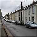
On-street parking, Bwllfa Road, Cwmdare
On the south side of Bwllfa Road. Ahead for the centre of Cwmdare.
Image: © Jaggery
Taken: 11 Feb 2019
0.06 miles


