IMAGES TAKEN NEAR TO
Hillside, ABERDARE, CF44 8RN

Introduction

This page details the photographs taken nearby to Hillside, CF44 8RN by members of the Geograph project.

The Geograph project started in 2005 with the aim of publishing, organising and preserving representative images for every square kilometre of Great Britain, Ireland and the Isle of Man.

There are currently over 7.5m images from over14,400 individuals and you can help contribute to the project by visiting https://www.geograph.org.uk

Image Map


Images are licensed for reuse under creativecommons.org/licenses/by-sa/2.0
Notes
  • Clicking on the map will re-center to the selected point.
  • The higher the marker number, the further away the image location is from the centre of the postcode.

Image Listing (98 Images Found)

Images are licensed for reuse under creativecommons.org/licenses/by-sa/2.0
  • ...
Image
Details
Distance
1
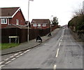
Maes-y-Coed, Cwmdare
Looking NE from Heol Brynnau.
Image: © Jaggery Taken: 5 Feb 2015
0.02 miles
2
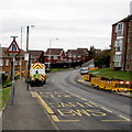
Maes Brynna, Cwmdare
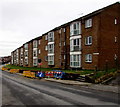
Three-storey block of flats south of Cwmdare Road.
Image: © Jaggery Taken: 11 Feb 2019
0.04 miles
3
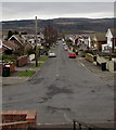
Heol Brynnau, Cwmdare
Looking SSE from the corner of Maes-y-Coed.
Image: © Jaggery Taken: 5 Feb 2015
0.07 miles
4
Yellow barrier enclosing a hole in the road, Cwmdare
On Heol Brynnau, viewed in early February 2015 during extensive gas mains replacement work in the area by Wales & West Utilities. Hafod Wen http://www.geograph.org.uk/photo/4337038 is on the left.
Image: © Jaggery Taken: 5 Feb 2015
0.08 miles
5
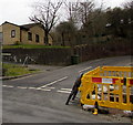
Side road to Maes y Coed, Cwmdare
From the south side of Cwmdare Road. The notice on the wall behind the car shows MAES Y COED 13-35
Image: © Jaggery Taken: 11 Feb 2019
0.08 miles
6
Yellow barriers in front of Heol Brynnau houses in Cwmdare
The barriers enclose holes in the ground during gas mains replacement in early February 2015.
Image: © Jaggery Taken: 5 Feb 2015
0.08 miles
7
Wales & West Utilities van in Heol Brynnau, Cwmdare
Viewed in early February 2015 during extensive gas mains replacement work in the area.
Image: © Jaggery Taken: 5 Feb 2015
0.08 miles
8
Hafod Wen, Cwmdare
Houses parallel with, and above, Heol Brynnau.
Image: © Jaggery Taken: 5 Feb 2015
0.08 miles
9
Hillside, Cwmdare
Viewed from steps down from Heol Brynnau to the street named Hillside which extends for about 220 metres to Broncynon Terrace.
Image: © Jaggery Taken: 5 Feb 2015
0.08 miles
10
Maes Melyn, Cwmdare
3-storey row of flats on the south side of Heol Brynnau. In early February 2015, there are many yellow (and some blue) barriers in this area during gas mains replacement work. The bus stop is temporarily out of use.
Image: © Jaggery Taken: 5 Feb 2015
0.08 miles
  • ...