
IMAGES TAKEN NEAR TO
Clive Place, ABERDARE, CF44 8PF
Introduction
This page details the photographs taken nearby to Clive Place, CF44 8PF by members of the Geograph project.
The Geograph project started in 2005 with the aim of publishing, organising and preserving representative images for every square kilometre of Great Britain, Ireland and the Isle of Man.

There are currently over 7.5m images from over14,400 individuals and you can help contribute to the project by visiting https://www.geograph.org.uk
Image Map
Images are licensed for reuse under creativecommons.org/licenses/by-sa/2.0
Notes
- Clicking on the map will re-center to the selected point.
- The higher the marker number, the further away the image location is from the centre of the postcode.
Image Listing (77 Images Found)
Images are licensed for reuse under creativecommons.org/licenses/by-sa/2.0
Image
Details
Distance
1
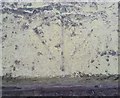
Ordnance Survey Pivot
This OS pivot can be found on the window sill of No21 Clive Street. It marks a point 146.033m above mean sea level.
Image: © Adrian Dust
Taken: 1 Jun 2017
0.03 miles
2
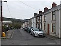
Clive Street, Trecynon
From the corner of Stag Street.
Image: © Jaggery
Taken: 3 May 2014
0.04 miles
3
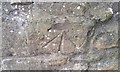
Ordnance Survey Cut Mark
This OS cut mark can be found on the wall dogleg in the lane. It marks a point 139.559m above mean sea level.
Image: © Adrian Dust
Taken: 1 Jun 2017
0.04 miles
4
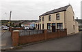
Richards Funeral Services, Trecynon, Aberdare
On the corner of Harriet Street and Clive Street.
Image: © Jaggery
Taken: 3 May 2014
0.05 miles
5
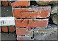
Ordnance Survey Cut Mark
This OS cut mark can be found at the entrance to No52 Mill Street. It marks a point 142.915m above mean sea level.
Image: © Adrian Dust
Taken: 1 Jun 2017
0.07 miles
6
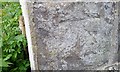
Ordnance Survey Cut Mark
This OS cut mark can be found on No1 Church Row. It marks a point 142.522m above mean sea level.
Image: © Adrian Dust
Taken: 1 Jun 2017
0.10 miles
7
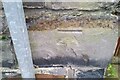
Ordnance Survey Cut Mark
This OS cut mark can be found on the wall of No1 Harriet Street. It marks a point 152.348m above mean sea level.
Image: © Adrian Dust
Taken: 7 Dec 2020
0.10 miles
8
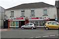
Tatlah Convenience Stores, Trecynon
Spar store at the eastern end of a row of shops in Mill Street.
Image: © Jaggery
Taken: 3 May 2014
0.11 miles
9
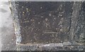
Ordnance Survey Cut Mark
This inverted OS cut mark can be found on the wall of No47 Harriet Street. It marks a point 152.348m above mean sea level.
Image: © Adrian Dust
Taken: 1 Jun 2017
0.11 miles
10
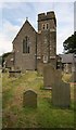
St Fagan's Church, Trecynon
View of St Fagan's Church, Trecynon.
Photos courtesy Aberdare Blog http://www.aberdareblog.co.uk/ which contains many hundreds of other Trecynon photos.
Image: © Darren W Rees
Taken: 24 Jul 2008
0.12 miles