1
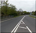
A4059 from Trecynon to Hirwaun
Viewed from near the roundabout at the B4276 Harriet Street junction in Trecynon.
Image: © Jaggery
Taken: 3 May 2014
0.12 miles
2
St Fagan's Church, Trecynon
View of St Fagan's Church, Trecynon.
Photos courtesy Aberdare Blog http://www.aberdareblog.co.uk/ which contains many hundreds of other Trecynon photos.
Image: © Darren W Rees
Taken: 24 Jul 2008
0.12 miles
3
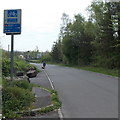
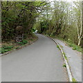
SE along the Cynon Trail, Llwydcoed
This route is part of the Cynon Trail and National Cycle Network route 478.
Distances shown are 1¼ (miles) to Aberdare railway station, ¾ mile to Robertstown.
Image: © Jaggery
Taken: 3 May 2014
0.13 miles
4
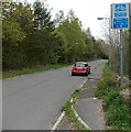
20 zone along Trefelin, Trecynon
Viewed across Harriet Street.
Image: © Jaggery
Taken: 3 May 2014
0.13 miles
5
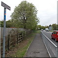
Cynon Trail distances from Trecynon
The sign is alongside Gelli Isaf, a quiet side road running parallel with the A4059.
Cynon Trail distances shown are 5 (miles) to Penderyn, 2½ to Hirwaun and 1¼ to Pen-y-waun.
Image: © Jaggery
Taken: 3 May 2014
0.13 miles
6
Ordnance Survey Cut Mark
This OS cut mark can be found on No1 Church Row. It marks a point 142.522m above mean sea level.
Image: © Adrian Dust
Taken: 1 Jun 2017
0.14 miles
7
Cynon Trail, Trecynon
For about 20 metres, the route of the Cynon Trail (and National Cycle Network route 47) is alongside the A4059, before branching off to the left to follow a more typical quieter route.
Image: © Jaggery
Taken: 3 May 2014
0.14 miles
8
Ordnance Survey Cut Mark
This inverted OS cut mark can be found on the wall of No47 Harriet Street. It marks a point 152.348m above mean sea level.
Image: © Adrian Dust
Taken: 1 Jun 2017
0.16 miles
9
Bridgend Inn, Trecynon
On the corner of Harriet Street and the A4059.
Image: © Jaggery
Taken: 3 May 2014
0.17 miles
10
Community route - no motorcycles, Llwydcoed
Part of the Cynon Trail and National Cycle Network route 478.
Image: © Jaggery
Taken: 3 May 2014
0.17 miles


