
IMAGES TAKEN NEAR TO
The Dell, ABERDARE, CF44 8BF
Introduction
This page details the photographs taken nearby to The Dell, CF44 8BF by members of the Geograph project.
The Geograph project started in 2005 with the aim of publishing, organising and preserving representative images for every square kilometre of Great Britain, Ireland and the Isle of Man.

There are currently over 7.5m images from over14,400 individuals and you can help contribute to the project by visiting https://www.geograph.org.uk
Image Map
Images are licensed for reuse under creativecommons.org/licenses/by-sa/2.0
Notes
- Clicking on the map will re-center to the selected point.
- The higher the marker number, the further away the image location is from the centre of the postcode.
Image Listing (35 Images Found)
Images are licensed for reuse under creativecommons.org/licenses/by-sa/2.0
Image
Details
Distance
1
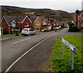
The Dell, Cwmdare
Cul-de-sac on the SW side of The Ridings.
Image: © Jaggery
Taken: 5 Feb 2015
0.02 miles
2
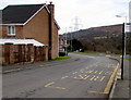
Lakeside bus stop in Cwmdare
Alongside The Ridings, between the turning for The Dell ahead and Lakeside behind the camera.
Image: © Jaggery
Taken: 5 Feb 2015
0.04 miles
3
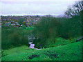
Looking towards Cwmdare
Taken from above the cascade in Dare Valley Country Park. Brecon Beacons in the distance.
Image: © Pauline Evans
Taken: Unknown
0.04 miles
4
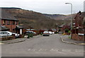
Lakeside, Cwmdare
Long cul-de-sac on the SW side of The Ridings. The far end is at the edge of the Dare Valley Country Park.
Image: © Jaggery
Taken: 5 Feb 2015
0.05 miles
5
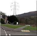
Pylon SE of The Dell, Cwmdare
The pylon is about 90 metres from the camera.
Image: © Jaggery
Taken: 5 Feb 2015
0.07 miles
6
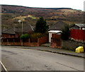
Yellow grit box and an electricity substation in The Ridings, Cwmdare
The Western Power Distribution electricity substation is set back a couple of metres
from the west side of The Ridings. Its identifier is DARREN PARK S/S 552008.
Image: © Jaggery
Taken: 5 Feb 2015
0.10 miles
7
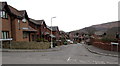
Cascade View, Cwmdare
Cul-de-sac on the SE side of The Ridings. Unlike in many other parts of Wales, there are no bilingual
street names in this area. A few, as Cascade View and The Ridings, are English only. Most are Welsh only.
Image: © Jaggery
Taken: 5 Feb 2015
0.11 miles
8
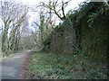
Dismantled railway in Dare Valley Country Park
The course of a former railway is now a path running up the valley on the south bank of the river Dare.
Image: © Nigel Davies
Taken: 5 Apr 2008
0.11 miles
9
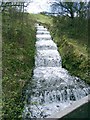
Cascade in Dare Valley Country Park
Water feeds down from the higher parts of the park to feed an artificial lake behind a weir in the river.
Image: © Nigel Davies
Taken: 5 Apr 2008
0.12 miles
10
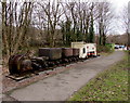
Old industrial train on display in Dare Valley Country Park
The locomotive http://www.geograph.org.uk/photo/4516658 and metal trucks are on a disconnected length of railway track near the visitor centre in Dare Valley Country Park, between Aberdare and Cwmdare, on land formerly occupied by coal pits.
The device on the left looks like winding gear. Only fragments of inscriptions on the side are legible.
The remainder has been damaged by weathering and by several small impact craters created by airgun pellets.
Image: © Jaggery
Taken: 5 Feb 2015
0.14 miles