1
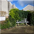
Remains of a long-since demolished railway bridge, Gadlys Road, Aberdare
More than a century ago there was an industrial railway in this area. Part of its route is now the East Avenue roadway. The railway bridge over Gadlys Road at this point was demolished in 1912 after closure of the railway.
Image: © Jaggery
Taken: 3 May 2014
0.01 miles
2
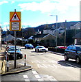
Zebra crossing warning sign, Gadlys Road, Aberdare
The bilingual sign on the corner of Elm Grove shows that Zebra Crossing is Croesfan Sebra in Welsh.
The letter Z is not in the standard Welsh alphabet.
Image: © Jaggery
Taken: 4 Feb 2019
0.02 miles
3
Ordnance Survey Cut Mark
This OS cut mark can be found on No95 Gadlys Road. It marks a point 135.362m above mean sea level.
Image: © Adrian Dust
Taken: 7 Dec 2020
0.02 miles
4
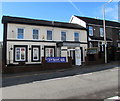
Mackworth, Aberdare
Pub at 25 Gadlys Road, formerly The Mackworth Arms.
Image: © Jaggery
Taken: 3 May 2014
0.02 miles
5
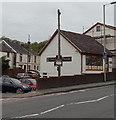
The Mackworth Arms, 25 Gadlys Road, Aberdare
Viewed across the B4275 Gadlys Road in February 2019.
The pub name was Mackworth in May 2014. https://www.geograph.org.uk/photo/3964842
Image: © Jaggery
Taken: 4 Feb 2019
0.02 miles
6
Solo Hair Design in Aberdare
Business at 23 Gadlys Road, on the corner of Morgan Street.
Image: © Jaggery
Taken: 3 May 2014
0.04 miles
7
Elm Grove, Gadlys, Aberdare
Houses dating from the early 20th century, on the north side of Elm Grove, viewed from the Gadlys Road end.
Image: © Jaggery
Taken: 28 Apr 2010
0.04 miles
8
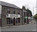
Glandover Arms, Gadlys, Aberdare
Pub at 98 Gadlys Road, opposite the Morgan Street junction.
Image: © Jaggery
Taken: 3 May 2014
0.04 miles
9
Ordnance Survey Cut Mark
This OS cut mark can be found on the wall of No7 Elm Grove. It marks a point 136.054m above mean sea level.
Image: © Adrian Dust
Taken: 1 Jun 2017
0.04 miles
10
Metal bench on an Aberdare corner
On the Gadlys Road side of the corner of Neville Terrace.
Image: © Jaggery
Taken: 4 Feb 2019
0.04 miles


