1
Playground in front of Ty Fry houses, Aberdare
Viewed from Dare Valley Country Park.
Image: © Jaggery
Taken: 5 Feb 2015
0.07 miles
2
Entrance to St. Margaret's School
Catholic Primary school off Harlech Place.
Image: © Jonathan Billinger
Taken: 22 Aug 2013
0.08 miles
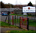
3
Welcome to St Margaret's Roman Catholic School, Aberdare
This entrance is from the street named Ty Fry, near the corner of Heol-y-Mynydd.
Image: © Jaggery
Taken: 5 Feb 2015
0.08 miles
4
Hen faes parcio / Disused car Park
Cerddwyr yn mynd drwy hen faes parcio yn Aberdar.
Walkers going through a disused car park in Aberdare < Aberdar (trans. confluence of the oak river).
Image: © Alan Richards
Taken: 30 Jul 2016
0.10 miles
5
Playground at the edge of St Margaret's Roman Catholic School, Aberdare
Some of the school buildings are on the right. A fence separates the playground from the school grounds.
Image: © Jaggery
Taken: 5 Feb 2015
0.10 miles
6
Harlech Place, Aberdare
A sign in front of Harlech Place pointing left shows ARNOTT'S PLACE though
the name sign alongside the row of houses (out of shot) http://www.geograph.org.uk/photo/4339235 shows ARNOTT PLACE.
Image: © Jaggery
Taken: 5 Feb 2015
0.10 miles
7
Fenced-off site on the north side of Highland Place, Aberdare
In early February 2015, little remains to indicate what used to be here.
Behind the fence are a few fragments of rubble, traffic cones and grass.
Image: © Jaggery
Taken: 5 Feb 2015
0.11 miles
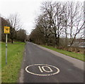
8
10mph speed limit through Dare Valley Country Park
This is the Aberdare (eastern) part of the road through the country park.
Image: © Jaggery
Taken: 5 Feb 2015
0.11 miles
9
Eastern entrance to the Dare Valley Country Park
From Heol-y-Mynydd Aberdare into 500 acres of countryside walks and trails between Aberdare and Cwmdare.
Image: © Jaggery
Taken: 5 Feb 2015
0.11 miles
10
No through road from Aberdare to Cwmdare
The yellow notice is near the Heol-y-Mynydd entrance http://www.geograph.org.uk/photo/4341317 at the eastern edge of the Dare Valley Country Park. This is not a through route for motor vehicles, but walkers and cyclists can reach Cwmdare this way.
Below the yellow sign, a smaller sign shows a maximum £1,000 fine on conviction for dog owners who do not clean up their pet's droppings.
Image: © Jaggery
Taken: 5 Feb 2015
0.12 miles


