1
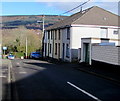
Row of four houses, Beddoe Street, Aberaman
Near the northeast end of Beddoe Street on the approach to the Belmont Terrace junction.
Image: © Jaggery
Taken: 4 Feb 2019
0.03 miles
2
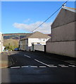
Junction of Beddoe Street and Davis Street, Aberaman
Looking to the NNE along Beddoe Street.
Image: © Jaggery
Taken: 4 Feb 2019
0.04 miles
3
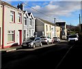
ESE along Davis Street, Aberaman
Looking to the east southeast from the corner of Beddoe Street along Davis Street towards Park Road.
Image: © Jaggery
Taken: 4 Feb 2019
0.05 miles
4
Welsh inscription on Saron Chapel, Aberaman
Faded in February 2019, the inscription records that the independent chapel https://www.geograph.org.uk/photo/6053934
was erected in 1849, enlarged in 1856, renovated in 1871 and 1890.
Image: © Jaggery
Taken: 4 Feb 2019
0.05 miles
5
North side of Grade II listed Saron Chapel, Aberaman
The Davis Street side of the chapel on the corner of Beddoe Street. The Welsh inscription https://www.geograph.org.uk/photo/6053948 on the wall records that the building was erected in 1849 as an independent chapel. It was enlarged in 1856, renewed in 1871 and 1890. Grade II listed in 1999 as a mid 19th century chapel foundation retaining an exceptionally fine interior of the later 19th century.
Image: © Jaggery
Taken: 4 Feb 2019
0.05 miles
6
Ordnance Survey Cut Mark
This OS cut mark can be found on the all of the Saron Chapel. It marks a point 124.554m above mean sea level.
Image: © Adrian Dust
Taken: 15 Apr 2018
0.05 miles
7
Saron Chapel, Davis Street, Aberaman
Saron Chapel, Davies Street, Aberaman.
Image: © Darren W Rees
Taken: 6 Feb 2008
0.05 miles
8
Ordnance Survey Cut Mark
This OS cut mark can be found on the One Stop shop. It marks a point 403.63ft above mean sea level.
Image: © Adrian Dust
Taken: 15 Apr 2018
0.07 miles
9
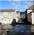
Minor crossroads in Aberaman
Beddoe Street is on the camera side and ahead. Lewis Street is on the left and right.
Image: © Jaggery
Taken: 4 Feb 2019
0.08 miles
10
Boarded-up former shop, Lewis Street, Aberaman
Viewed in February 2019.
Image: © Jaggery
Taken: 4 Feb 2019
0.08 miles


