IMAGES TAKEN NEAR TO
Cardiff Road, ABERDARE, CF44 6YA

Introduction

This page details the photographs taken nearby to Cardiff Road, CF44 6YA by members of the Geograph project.

The Geograph project started in 2005 with the aim of publishing, organising and preserving representative images for every square kilometre of Great Britain, Ireland and the Isle of Man.

There are currently over 7.5m images from over14,400 individuals and you can help contribute to the project by visiting https://www.geograph.org.uk

Image Map


Images are licensed for reuse under creativecommons.org/licenses/by-sa/2.0
Notes
  • Clicking on the map will re-center to the selected point.
  • The higher the marker number, the further away the image location is from the centre of the postcode.

Image Listing (57 Images Found)

Images are licensed for reuse under creativecommons.org/licenses/by-sa/2.0
  • ...
Image
Details
Distance
1
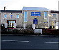
Gateway Church, Aberaman
At 281 Cardiff Road viewed in February 2019. The name on the wall in May 2010 was Pentecostal Church. https://www.geograph.org.uk/photo/1846343
Image: © Jaggery Taken: 4 Feb 2019
0.01 miles
2
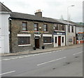
Rock Inn, Aberaman
Located on Cardiff Road, next door to the Royal British Legion premises. http://www.geograph.org.uk/photo/1846347 Originally a coaching inn dating back to at least the middle of the nineteenth century.
Image: © Jaggery Taken: 7 May 2010
0.01 miles
3
Aberaman Royal British Legion
Royal British Legion premises at the eastern end of Lewis Street, at the junction with Cardiff Road.
Image: © Jaggery Taken: 7 May 2010
0.01 miles
4
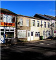
Junction in Aberaman
Lewis Street on the right diverges from the B4275 Cardiff Road. A red phonebox is on the corner
Image: © Jaggery Taken: 4 Feb 2019
0.03 miles
5
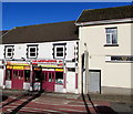
The Sun in Aberaman
Chinese takeaway in Lewis Street.
Image: © Jaggery Taken: 4 Feb 2019
0.03 miles
6
Marmaris in Aberaman
Marmaris Kebab & Grill House takeaway is at 34 Lewis Street.
Image: © Jaggery Taken: 4 Feb 2019
0.03 miles
7
Ordnance Survey Cut Mark
This OS cut mark can be found on the One Stop shop. It marks a point 403.63ft above mean sea level.
Image: © Adrian Dust Taken: 15 Apr 2018
0.03 miles
8
Y Lleng/The Legion, Lewis Street, Aberaman
Sports & social club viewed in February 2019. The name on the premises in May 2010 was Aberaman Royal British Legion. https://www.geograph.org.uk/photo/1846347
Image: © Jaggery Taken: 4 Feb 2019
0.04 miles
9
Ordnance Survey Cut Mark
This OS cut mark can be found on the Rock Inn. It marks a point 125.191m above mean sea level.
Image: © Adrian Dust Taken: 15 Apr 2018
0.04 miles
10
Rock Inn, 167 Cardiff Road, Aberaman
Pub on the corner of Lewis Street.
Image: © Jaggery Taken: 4 Feb 2019
0.04 miles
  • ...