1
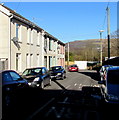
Primrose Terrace, Aberaman, Aberdare
Looking north from Ynys-Lwyd Road.
Image: © Jaggery
Taken: 19 Jan 2015
0.01 miles
2
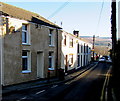
Ynys-Lwyd Road, Aberaman, Aberdare
Looking east from the B4275 Cardiff Road end. The left turn ahead is into Primrose Terrace. http://www.geograph.org.uk/photo/4315944
Image: © Jaggery
Taken: 19 Jan 2015
0.02 miles
3
Blaengwawr Stores, Aberdare
Premier convenience store and off licence at 69 Cardiff Road.
Image: © Jaggery
Taken: 19 Jan 2015
0.03 miles
4
Ordnance Survey Cut Mark
This OS cut mark can be found on the wall of No77 Cardiff Road. It marks a point 123.828m above mean sea level.
Image: © Adrian Dust
Taken: 22 Apr 2018
0.04 miles
5
Blaengwawr Inn, Aberaman, Aberdare
The pub at 373 Cardiff Road has had a makeover since this http://www.geograph.org.uk/photo/1846094 view taken in May 2010.
Image: © Jaggery
Taken: 19 Jan 2015
0.04 miles
6
Bus stop
Bus stop alongside the Blaengwawr Inn, Aberaman.
Image: © Alan Hughes
Taken: 16 Mar 2020
0.05 miles
7
Wall postbox alongside a speed limit change on Cardiff Road, Aberdare
The 20mph speed limit on the approach to a school behind the camera
increases to 30mph opposite a King George VI postbox in a house wall.
Image: © Jaggery
Taken: 19 Jan 2015
0.05 miles
8
Violet Street, Aberaman, Aberdare
Viewed from the Primrose Terrace end looking towards the A4059.
Image: © Jaggery
Taken: 19 Jan 2015
0.06 miles
9
No pedestrians ahead, Aberdare
Near the southern edge of this http://www.geograph.org.uk/photo/4317633 footbridge, the red-edged circular sign indicates no pedestrians. Walkers can use a nearby gate to Violet Street.
Image: © Jaggery
Taken: 19 Jan 2015
0.06 miles
10
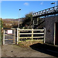
Gate to an A4059 footbridge, Aberdare
At the northern end of Violet Street, the gate gives access to this http://www.geograph.org.uk/photo/4317633 footbridge.
Image: © Jaggery
Taken: 19 Jan 2015
0.06 miles


