
IMAGES TAKEN NEAR TO
Brynhyfryd, ABERDARE, CF44 6LG
Introduction
This page details the photographs taken nearby to Brynhyfryd, CF44 6LG by members of the Geograph project.
The Geograph project started in 2005 with the aim of publishing, organising and preserving representative images for every square kilometre of Great Britain, Ireland and the Isle of Man.

There are currently over 7.5m images from over14,400 individuals and you can help contribute to the project by visiting https://www.geograph.org.uk
Image Map
Images are licensed for reuse under creativecommons.org/licenses/by-sa/2.0
Notes
- Clicking on the map will re-center to the selected point.
- The higher the marker number, the further away the image location is from the centre of the postcode.
Image Listing (36 Images Found)
Images are licensed for reuse under creativecommons.org/licenses/by-sa/2.0
Image
Details
Distance
1
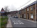
Slow down - playground ahead, Glanaman Road, Cwmaman
The entrance to the playground http://www.geograph.org.uk/photo/3923888 is behind the tree on the left.
Image: © Jaggery
Taken: 22 Feb 2014
0.04 miles
2
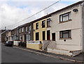
Glanaman Road houses, Cwmaman
The houses are opposite a recreation ground.
Image: © Jaggery
Taken: 22 Feb 2014
0.05 miles
3
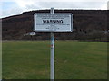
Warning notice at the edge of Glanaman Road recreation ground, Cwmaman
The Rhondda Cynon Taff County Borough Council's Leisure and Tourism Department's notice
lists three activities that are "strictly forbidden on these premises".
Listed are playing of golf, riding of motorcycles, horse riding.
No mention is made of lighting a bonfire, digging up the field or erecting a 3-ring circus...
Image: © Jaggery
Taken: 22 Feb 2014
0.05 miles
4
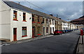
Houses on the north side of Glanaman Road, Cwmaman
Viewed looking east.
Image: © Jaggery
Taken: 22 Feb 2014
0.05 miles
5
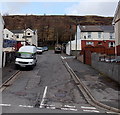
Unnamed connecting road in Cwmaman
The road connects Glanaman Road on the camera side with Kingsbury Place on the right and Brynhyfryd on the left.
Image: © Jaggery
Taken: 22 Feb 2014
0.06 miles
6
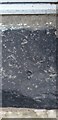
Ordnance Survey Rivet
This OS rivet can be found on the window sill of No44 Glanaman Road. It marks a point 188.632m above mean sea level.
Image: © Adrian Dust
Taken: 22 Apr 2018
0.08 miles
7
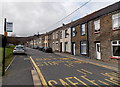
Glanaman Road bus stops, Cwmaman
These bus stops are one stop away from the terminus near the western edge of the village (ahead).
A bus stopping at or passing the stop on the left side of the road will stop at or pass the stop on the right side a few minutes later.
Image: © Jaggery
Taken: 22 Feb 2014
0.08 miles
8
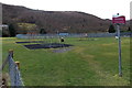
Children's playground in Cwmaman
Viewed from the entrance gate at the edge of Glanaman Road.
Image: © Jaggery
Taken: 22 Feb 2014
0.09 miles
9
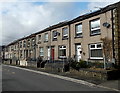
Row of houses, Glanaman Road, Cwmaman
Looking west from near this pharmacy. http://www.geograph.org.uk/photo/3923782
Image: © Jaggery
Taken: 22 Feb 2014
0.10 miles
10
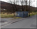
Electricity substation compound, Glanaman Road, Cwmaman
The identifier on the Western Power Distribution electricity substation is CWMAMAN S/S 552138.
Image: © Jaggery
Taken: 22 Feb 2014
0.11 miles