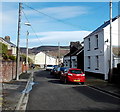
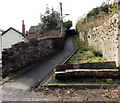
IMAGES TAKEN NEAR TO
Gerddi'r Maes Bach, CF44 6DQ

Introduction

This page details the photographs taken nearby to Gerddi'r Maes Bach, CF44 6DQ by members of the Geograph project.

The Geograph project started in 2005 with the aim of publishing, organising and preserving representative images for every square kilometre of Great Britain, Ireland and the Isle of Man.

There are currently over 7.5m images from over14,400 individuals and you can help contribute to the project by visiting https://www.geograph.org.uk

Image Map


Images are licensed for reuse under creativecommons.org/licenses/by-sa/2.0
Notes
  • Clicking on the map will re-center to the selected point.
  • The higher the marker number, the further away the image location is from the centre of the postcode.

Image Listing (23 Images Found)

Images are licensed for reuse under creativecommons.org/licenses/by-sa/2.0
  • ...
Image
Details
Distance
1
Accommodation ahead, Foundry View, Aberaman
The sign is a few metres beyond the end of the houses in Foundry View. The road ahead is alongside the Aman River.
Image: © Jaggery Taken: 22 Feb 2014
0.06 miles
2
Keep out signs on field gates near Aberaman
The field is at the edge of the Aman River.
Image: © Jaggery Taken: 22 Feb 2014
0.07 miles
3
Small tributary of the River Aman, Aberman
A small stream flows between two Foundry View houses, towards the Aman about 70 metres ahead.
Image: © Jaggery Taken: 22 Feb 2014
0.09 miles
4
Foundry View, Aberaman
Looking NE along Foundry View towards Forge View.
Image: © Jaggery Taken: 22 Feb 2014
0.09 miles
5
Forge View houses, Aberaman
Looking along Forge View towards Foundry View.
Image: © Jaggery Taken: 22 Feb 2014
0.09 miles
6
Ordnance Survey Cut Mark
This OS cut mark can be found on the railway bridge. It marks a point 167.070m above mean sea level.
Image: © Adrian Dust Taken: 19 Jan 2018
0.12 miles
7
Cwmaman Road, Aberaman
Yes it is as steep as it looks!
Image: © Jonathan Billinger Taken: 4 Oct 2008
0.12 miles
8
Small waterfall near Cwmaman
White water falls a few metres into the Aman River.
Image: © Jaggery Taken: 22 Feb 2014
0.16 miles
9
Forge Row Jubilee Garden, Aberaman
Viewed in late February 2014. The name Forge Row Jubilee Garden is on the log beyond the western edge of Forge Row. The long narrow garden, created for Queen Elizabeth II's Diamond Jubilee in 2012, is alongside the footpath to Forge View and Foundry View.
Image: © Jaggery Taken: 22 Feb 2014
0.16 miles
10
Cwmaman Road, Aberaman
One of the wider roads in the town, used as a distributor to the rows of mining houses lining the hillside.
Image: © Graham Horn Taken: 4 Oct 2008
0.16 miles
  • ...