1
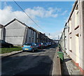
Jenkin Street Abercwmboi
Looking NW from the corner of Mary Street towards William Street.
Image: © Jaggery
Taken: 22 Feb 2014
0.06 miles
2
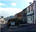
Clarks Carpets, Abercwmboi
The carpet shop is set back from John Street, on the west side of Cap Coch. http://www.geograph.org.uk/photo/3882780
Image: © Jaggery
Taken: 22 Feb 2014
0.06 miles
3
Cap Coch, Abercwmboi
Pub on the south side of John Street. A 19th century map shows that Abercwmboi was named Cap Coch (Red Cap) at that time, though a nearby wood is shown as Coed Abercwmboi and Abercwmboi Colliery was to the east of the residential part of the village.
Image: © Jaggery
Taken: 22 Feb 2014
0.06 miles
4
Wok-U-Like in Abercwmboi
Chinese takeaway at 113 John Street, on the corner of Cromer Street.
Image: © Jaggery
Taken: 22 Feb 2014
0.07 miles
5
John Street, Abercwmboi
The B4275 through Abercwmboi, is the main street. It is characterised by rows of mining town terraced houses, and these days extensive traffic calming.
Image: © Graham Horn
Taken: 4 Oct 2008
0.08 miles
6
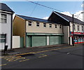
Former Melbourne Star in Abercwmboi
Viewed across the B4275 John Street in February 2014. http://www.geograph.org.uk/photo/996679 to an October 2008 view.
Image: © Jaggery
Taken: 22 Feb 2014
0.08 miles
7
Abercwmboi Medical Practice
Viewed across the B4275 John Street in Abercwmboi. Sheppards Pharmacy http://www.geograph.org.uk/photo/3860278 is on the right.
Image: © Jaggery
Taken: 22 Feb 2014
0.08 miles
8
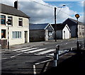
Zebra crossing in Abercwmboi
Across the B4275 Park View Terrace near the corner of Cromer Street.
Although Belisha beacons had marked pedestrian crossings in the UK from 1934, it was not until 1951 that the now familiar black and white stripes stretching across the width of the road were officially introduced. Previously, there were only metal studs across the road surface.
Image: © Jaggery
Taken: 22 Feb 2014
0.08 miles
9
Abercwmboi Medical Practice
View along John Street, Abercwmboi.
Image: © Alan Hughes
Taken: 27 Mar 2019
0.09 miles
10
Sheppards Pharmacy, Abercwmboi
Located next door to Abercwmboi Medical Practice http://www.geograph.org.uk/photo/3860274 on the left.
Image: © Jaggery
Taken: 22 Feb 2014
0.09 miles


