1
Rhoswenallt Inn, Abernant, Aberdare
Viewed across Abernant Road from the corner of Pant-yr-Eos.
Image: © Jaggery
Taken: 26 Feb 2014
0.12 miles
2
Ordnance Survey Cut Mark
This OS cut mark can be found on the Rhoswenallt PH. It marks a point 195.243m above mean sea level.
Image: © Adrian Dust
Taken: 2 May 2024
0.12 miles
3
Abernant station
The short branch train from Merthyr Tydfil to Hirwaun pauses at Abernant shortly before closure of the line. Built originally to carry traffic between Merthyr and Neath, in later years passengers had to change at Hirwaun onto a Neath-bound train which had come up the Cynon Valley.
Image: © Flying Stag
Taken: Unknown
0.13 miles
4
Platform at the site of Abernant railway station, Aberdare
Much of the platform remains in 2014 on the site of Abernant railway station
where passenger services ceased in 1962. The railbed is now a public footpath.
http://www.geograph.org.uk/photo/3016433 to FlyingStag's 1962 photo of a train in the station.
Image: © Jaggery
Taken: 26 Feb 2014
0.13 miles
5
Sticil yn Abernant / Stile in Abernant
Llwybr yn dod i lawr o'r ucheldir i gyfeiriad Abernant.
A footpath descending from the upland and approaching the settlement of Abernant (trans. confluence of the stream).
Image: © Alan Richards
Taken: 12 Jul 2017
0.13 miles
6
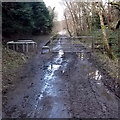
Muddy footpath approaches the site of Abernant railway station, Aberdare
A path from Cwmbach reaches barriers beyond which are the remains of a station platform. http://www.geograph.org.uk/photo/3999418
Image: © Jaggery
Taken: 26 Feb 2014
0.14 miles
7
NW end of a former railway station platform, Abernant, Aberdare
The rest of Abernant railway station, where passenger services ceased in 1962, has been demolished, leaving only this platform, alongside what is now a public footpath.
http://www.geograph.org.uk/photo/3016433 to Flying Stag's 1962 photo of a train in the station.
Image: © Jaggery
Taken: 26 Feb 2014
0.14 miles
8
Rhoswenallt Inn
Public house in Abernant.
Image: © Alan Hughes
Taken: 20 Aug 2022
0.14 miles
9
Railway path notice, Abernant, Aberdare
Located alongside the Llwydcoed to Cwmbach railway path following the route of a dismantled railway near the site of the former Abernant station where a platform remains. http://www.geograph.org.uk/photo/3999418
Image: © Jaggery
Taken: 26 Feb 2014
0.15 miles
10
Heol Pen-nant, Abernant, Aberdare
Heol Pen-nant is a row of four houses adjacent to Pant-yr-eos, viewed across Abernant Road.
Image: © Jaggery
Taken: 26 Feb 2014
0.16 miles


