IMAGES TAKEN NEAR TO
Pontpren, ABERDARE, CF44 0SJ

Introduction

This page details the photographs taken nearby to Pontpren, CF44 0SJ by members of the Geograph project.

The Geograph project started in 2005 with the aim of publishing, organising and preserving representative images for every square kilometre of Great Britain, Ireland and the Isle of Man.

There are currently over 7.5m images from over14,400 individuals and you can help contribute to the project by visiting https://www.geograph.org.uk

Image Map


Images are licensed for reuse under creativecommons.org/licenses/by-sa/2.0
Notes
  • Clicking on the map will re-center to the selected point.
  • The higher the marker number, the further away the image location is from the centre of the postcode.

Image Listing (18 Images Found)

Images are licensed for reuse under creativecommons.org/licenses/by-sa/2.0
Image
Details
Distance
1
Llwybr i'r comin / Path to the common
Sticil yn rhoi mynediad i'r comin. Path giving access to the common.
Image: © Alan Richards Taken: 21 Feb 2018
0.03 miles
2
Ford at Penderyn
A public footpath fords the Afon Cynon just east of Penderyn village. A footbridge alternative is available immediately upstream for the faint-hearted and dry-footed. Just beyond the ford is the Penderyn Quarry Line Cycle and walkway.
Image: © Alan Bowring Taken: 3 Jul 2007
0.05 miles
3
Ford and footbridge on the Afon Cynon in Penderyn
Image: © Gareth James Taken: 24 Feb 2017
0.05 miles
4
Penderyn Community Centre
The new Penderyn Community Centre, extended in 2007.
Image: © Darren W Rees Taken: 6 Feb 2008
0.09 miles
5
Entrance to Welsh Water site, Penderyn
Access road to Twll Turio, Penderyn.
Image: © Alan Hughes Taken: 25 Jan 2021
0.10 miles
6
Hen wal sych / Old dry stone wall
Hen wal sych ar gomin ym Mhenderyn. Old dry stone wall on a common in Penderyn (trans. bird's head).
Image: © Alan Richards Taken: 21 Feb 2018
0.13 miles
7
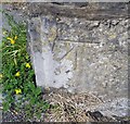
Ordnance Survey Cut Mark
This OS cut mark can be found on the gatepost of the chapel west side of the road. It marks a point 232.864m above mean sea level.
Image: © Adrian Dust Taken: 19 Jul 2020
0.14 miles
8
Siloam Baptist Chapel, Penderyn
Viewed across Pontpren (the A4059). A tablet in the wall above the doorway shows that the church was built in 1823, rebuilt in 1857.
Image: © Jaggery Taken: 29 Jul 2012
0.14 miles
9
Penderyn Community Centre
Set back from the west side of Pontpren (A4059) between Bryn Onnen and Church Road.
Image: © Jaggery Taken: 29 Jul 2012
0.14 miles
10
Siloam Chapel, Penderyn
Siloam Chapel, Penderyn.
Image: © Darren W Rees Taken: 6 Feb 2008
0.16 miles