1
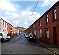
Windsor Terrace, Abernant, near Aberdare
Windsor Terrace, Abernant, near Aberdare.
Image: © Darren W Rees
Taken: 6 Feb 2008
0.06 miles
2
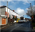
Fothergill Street, Abernant
On the east side of Abernant Road.
Image: © Jaggery
Taken: 26 Feb 2014
0.08 miles
3
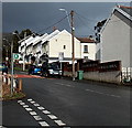
Hurst Grove, Abernant
A cul-de-sac viewed from the Abernant Road end.
Image: © Jaggery
Taken: 26 Feb 2014
0.13 miles
4
Park View Stores, Abernant
The Lifestyle Express convenience store is on the corner of Fothergill Street on the left and Park View Terrace on the right.
Image: © Jaggery
Taken: 26 Feb 2014
0.16 miles
5
Abernant Road houses, Abernant
Viewed from a side road. http://www.geograph.org.uk/photo/3863834
Image: © Jaggery
Taken: 26 Feb 2014
0.18 miles
6
St Matthew Church, Abernant
Clad with corrugated sheeting, this is one of only a handful of tin tabernacles in South Wales.
See https://en.wikipedia.org/wiki/St_Matthew%27s_Church,_Abernant.
See also https://en.wikipedia.org/wiki/Tin_tabernacle.
Image: © Alan Hughes
Taken: 20 Aug 2022
0.18 miles
7
St Matthew's Church, Abernant
Viewed from the entrance to the school next door. St Matthew's Church is in the Church in Wales parish of Aberdare. Affectionately known as a tin church, this corrugated metal building dates from 1888, erected as a mission church in the expectation that it would be in use for about a decade, when it would be replaced by a new, more substantial building. This late February 2014 view, more than a century and a quarter later, shows that it is still in use.
Image: © Jaggery
Taken: 26 Feb 2014
0.18 miles
8
Ysgol Gynradd Abernant
Abernant Junior School.
Image: © Alan Hughes
Taken: 20 Aug 2022
0.18 miles
9
Side road in Abernant
Viewed from the edge of Abernant Road. The side road leads to Moss Row, Moss Place and Little Row.
Image: © Jaggery
Taken: 26 Feb 2014
0.18 miles
10
Abernant Primary School
Viewed across Abernant Road opposite Richmond Terrace.
Image: © Jaggery
Taken: 26 Feb 2014
0.19 miles


