1
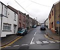
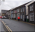
Ynyscynon Street, Cwmbach
Viewed across Cwmbach Road. Ynyscynon Street is not a through road for motor vehicles because there is a brick wall across the road 230 metres ahead. Walkers can reach Pinecoft Avenue beyond the far end of the street via steps at the side of the wall.
Image: © Jaggery
Taken: 19 Feb 2014
0.02 miles
2
Ynyscynon St, Cwmbach
Image: © John Lord
Taken: 3 Sep 2008
0.03 miles
3
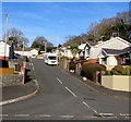
Ynyscynon Street houses, Cwmbach
Houses on the west side of the street ascending from Well Place.
Image: © Jaggery
Taken: 9 Jan 2019
0.04 miles
4
Bungalows on the corner of Fairfield Close and Well Place, Cwmbach
Originally, bungalow was used in English for a lightly-built house, with a veranda and one storey.
In current UK usage it is a convenient word for any one-storey dwelling.
Image: © Jaggery
Taken: 9 Jan 2019
0.05 miles
5
Fairfield Close bungalows, Cwmbach
Viewed across Cwmbach Road.
Image: © Jaggery
Taken: 19 Feb 2014
0.05 miles
6
Fairfield Close, Cwmbach
Cul-de-sac on the north side on Cwmbach Road.
Image: © Jaggery
Taken: 9 Jan 2019
0.05 miles
7
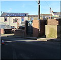
Ynyscynon electricity substation, Cwmbach
The Western Power Distribution electricity substation is in a brick enclosure on the north side of Well Place near the corner of Ynyscynon Street. https://www.geograph.org.uk/photo/3953637 The substation identifier is YNYSCYNON S/S 552256
Image: © Jaggery
Taken: 9 Jan 2019
0.06 miles
8
Postman and Royal Mail van in Cwmbach Road, Cwmbach
After making a delivery to a house in Cwmbach Road, a postman wearing an orange dayglo
jacket walks back towards the Royal Mail van at the left edge of the view.
Image: © Jaggery
Taken: 19 Feb 2014
0.06 miles
9
Track to Werfa Colliery
Further uphill from
Image
Image: © Alan Hughes
Taken: 20 Aug 2022
0.06 miles
10
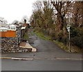
Public footpath north of Cwmbach Road, Cwmbach
A green and white public footpath sign on the corner of Cwmbach Road points along the route north.
Image: © Jaggery
Taken: 19 Feb 2014
0.07 miles


