1
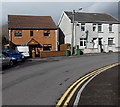
Dare Heating van, Bridge Road, Cwmbach
Dare Heating (plumbing & heating engineers) is based in nearby Aberdare.
Image: © Jaggery
Taken: 9 Jan 2019
0.01 miles
2
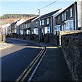
Houses at a bend in Bridge Road, Cwmbach
Cwmbach is a village near Aberdare.
Image: © Jaggery
Taken: 9 Jan 2019
0.01 miles
3
Houses at a bend in Bridge Road, Cwmbach
The year 2000 is inscribed on the house on the left.
Image: © Jaggery
Taken: 26 Feb 2014
0.01 miles
4
Former Cwmbach Infants School, Cwmbach
Viewed from Bridge Road in February 2014. Windows and doors are boarded up.
The school looks long abandoned.
Image: © Jaggery
Taken: 19 Feb 2014
0.02 miles
5
Relic of a demolished school, Bridge Road, Cwmbach
The Welcome/Croeso sign for Cwmbach Infants School/Ysgol Plant Bach Cwmbach
remains in place in January 2019 at the edge of the fenced-off site
of the demolished school. https://www.geograph.org.uk/photo/6021123
Image: © Jaggery
Taken: 9 Jan 2019
0.02 miles
6
Fenced-off site of a former school, Bridge Road, Cwmbach
Site of the demolished former Cwmbach Infants School viewed in January 2019.
The school buildings were derelict in this https://www.geograph.org.uk/photo/3856701 February 2014 photo.
Image: © Jaggery
Taken: 9 Jan 2019
0.03 miles
7
Zigzag markings on Bridge Road, Cwmbach
The markings indicating a Keep Clear Zone remain in place in January 2019,
though the adjacent former Cwmbach Infants School has been demolished. https://www.geograph.org.uk/photo/6021123
Image: © Jaggery
Taken: 9 Jan 2019
0.03 miles
8
Stone semis, Bridge Road, Cwmbach
Semi-detached houses on the east side of Bridge Road.
Image: © Jaggery
Taken: 9 Jan 2019
0.05 miles
9
St Mary Magdalene viewed from the south, Cwmbach
Viewed across Bridge Road from the corner of Bryn Glas. The Church in Wales church dates from 1882.
http://www.geograph.org.uk/photo/3864214 to a view from the north.
Image: © Jaggery
Taken: 26 Feb 2014
0.05 miles
10
Bridge St, Cwmbach
Image: © John Lord
Taken: 3 Sep 2008
0.05 miles


