IMAGES TAKEN NEAR TO
Conway Drive, ABERDARE, CF44 0LL
Introduction
This page details the photographs taken nearby to Conway Drive, CF44 0LL by members of the Geograph project.
The Geograph project started in 2005 with the aim of publishing, organising and preserving representative images for every square kilometre of Great Britain, Ireland and the Isle of Man.

There are currently over 7.5m images from over14,400 individuals and you can help contribute to the project by visiting https://www.geograph.org.uk
Image Map
Images are licensed for reuse under creativecommons.org/licenses/by-sa/2.0
Notes
- Clicking on the map will re-center to the selected point.
- The higher the marker number, the further away the image location is from the centre of the postcode.
Image Listing (18 Images Found)
Images are licensed for reuse under creativecommons.org/licenses/by-sa/2.0
Image
Details
Distance
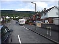
2
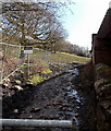
Track NW from Blaennantygroes Road, Cwmbach
The track heads towards farm buildings and trees at the edge of a stream, Nant y Groes.
Image: © Jaggery
Taken: 26 Feb 2014
0.13 miles
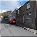
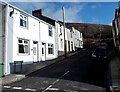
3
Incline Street, Cwmbach
Viewed from Waterloo Street.
Image: © Jaggery
Taken: 26 Feb 2014
0.17 miles
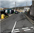
4
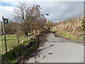
Blaennantygroes Road NE of Incline Road, Cwmbach
Looking towards Blaennantygroes Farm, out of shot about 350 metres ahead.
Image: © Jaggery
Taken: 26 Feb 2014
0.17 miles
5
Public footpath and private land, Cwmbach
Viewed from Blaennantygroes Road. The notice on the left has two parts.
The left side points left along a public footpath (please adhere to the footpath).
The right side points right towards private property - Keep Out.
Image: © Jaggery
Taken: 26 Feb 2014
0.19 miles
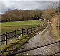
6
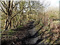
Public footpath towards Aberdare from Cwmbach
The path heads away from Blaennantygroes Road in Cwmbach
towards a path to Aberdare along the trackbed of a dismantled railway.
Image: © Jaggery
Taken: 26 Feb 2014
0.19 miles
7
Track from Blaennantygroes Road to the Railway Path, Cwmbach
Looking towards metal barriers. http://www.geograph.org.uk/photo/4324471
Image: © Jaggery
Taken: 26 Feb 2014
0.19 miles
8
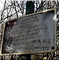
Railway Path notice, Cwmbach
Located here. http://www.geograph.org.uk/photo/4324471 The notice shows no cars or motorcycles on the Railway Path ahead.
It might be possible to squeeze a motorbike through the barriers, but a car?
Image: © Jaggery
Taken: 26 Feb 2014
0.19 miles
9
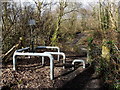
Metal barriers near the Railway Path, Cwmbach
The barriers prevent vehicular misuse of the footpath ahead,
the Railway Path, which uses the route of a dismantled railway.
Image: © Jaggery
Taken: 26 Feb 2014
0.19 miles
10
Daniel Street, Cwmbach
Daniel Street extends for 30 metres on the east side of Incline Road.
Image: © Jaggery
Taken: 26 Feb 2014
0.19 miles