
IMAGES TAKEN NEAR TO
Windermere Close, ABERDARE, CF44 0HU
Introduction
This page details the photographs taken nearby to Windermere Close, CF44 0HU by members of the Geograph project.
The Geograph project started in 2005 with the aim of publishing, organising and preserving representative images for every square kilometre of Great Britain, Ireland and the Isle of Man.

There are currently over 7.5m images from over14,400 individuals and you can help contribute to the project by visiting https://www.geograph.org.uk
Image Map
Images are licensed for reuse under creativecommons.org/licenses/by-sa/2.0
Notes
- Clicking on the map will re-center to the selected point.
- The higher the marker number, the further away the image location is from the centre of the postcode.
Image Listing (36 Images Found)
Images are licensed for reuse under creativecommons.org/licenses/by-sa/2.0
Image
Details
Distance
1
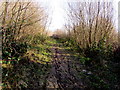
Muddy track through woodland, Cwmbach
Towards Windermere Close from the northern end of Parkfield Road. https://www.geograph.org.uk/photo/6020357
Image: © Jaggery
Taken: 9 Jan 2019
0.08 miles
2
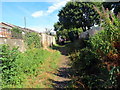
Hen ddramffordd Glofa Werfa / Former tramline to Werfa Colliery
Cerddwyr yn dilyn llwybr cyhoeddus a fu'n gynt yn ddramffordd a gludai lo o Lofa'r Werfa.
Walkers following a public footpath along a former tramline that transported coal from Werfa Colliery (trans. shaded place).
Image: © Alan Richards
Taken: 21 Jul 2018
0.08 miles
3
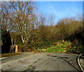
Northern end of Parkfield Road, Cwmbach
250 metres north of Cwmbach Road, Parkfield Road ends here at the edge of woodland.
Image: © Jaggery
Taken: 9 Jan 2019
0.10 miles
4
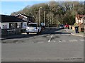
Heath Close, Cwmbach
Cul-de-sac on the west side of Parkfield Road.
Image: © Jaggery
Taken: 9 Jan 2019
0.13 miles
5
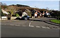
Meadowbank Close, Cwmbach
From Parkfield Road, Meadowbank Close leads to Bracken Rise.
Image: © Jaggery
Taken: 9 Jan 2019
0.14 miles
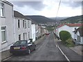
7
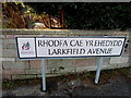
Bilingual street name sign, Larkfield Avenue, Cwmbach
The Rhondda Cynon Taf County Borough sign shows that Larkfield Avenue is Rhodfa Cae yr Ehedydd in Welsh.
Image: © Jaggery
Taken: 9 Jan 2019
0.15 miles
8
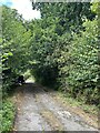
Track to Werfa Colliery
Further uphill from Image
Image: © Alan Hughes
Taken: 20 Aug 2022
0.15 miles
9
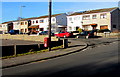
Houses on the north side of Brookbank Close, Cwmbach
Viewed across Parkfield Road.
Image: © Jaggery
Taken: 9 Jan 2019
0.18 miles
10
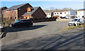
Ynyscynon Inn car park, Cwmbach
On the corner of Parkfield Road and Brookbank Close,
the car park is on the north side of the Ynyscynon Inn. https://www.geograph.org.uk/photo/6020433
Image: © Jaggery
Taken: 9 Jan 2019
0.18 miles