IMAGES TAKEN NEAR TO
Grasmere Drive, ABERDARE, CF44 0HP
Introduction
This page details the photographs taken nearby to Grasmere Drive, CF44 0HP by members of the Geograph project.
The Geograph project started in 2005 with the aim of publishing, organising and preserving representative images for every square kilometre of Great Britain, Ireland and the Isle of Man.

There are currently over 7.5m images from over14,400 individuals and you can help contribute to the project by visiting https://www.geograph.org.uk
Image Map
Images are licensed for reuse under creativecommons.org/licenses/by-sa/2.0
Notes
- Clicking on the map will re-center to the selected point.
- The higher the marker number, the further away the image location is from the centre of the postcode.
Image Listing (39 Images Found)
Images are licensed for reuse under creativecommons.org/licenses/by-sa/2.0
Image
Details
Distance
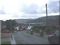
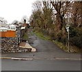
2
Track to Werfa Colliery
Further uphill from Image
Image: © Alan Hughes
Taken: 20 Aug 2022
0.07 miles
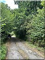
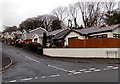
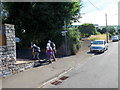
3
Hen ddramffordd Glofa Werfa / Former tramline to Werfa Colliery
Cerddwyr yn dilyn llwybr cyhoeddus a fu'n gynt yn ddramffordd a gludai lo o Lofa'r Werfa.
Walkers following a public footpath along a former tramline that transported coal from Werfa Colliery (trans. shaded place).
Image: © Alan Richards
Taken: 21 Jul 2018
0.09 miles
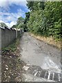
5
Public footpath north of Cwmbach Road, Cwmbach
A green and white public footpath sign on the corner of Cwmbach Road points along the route north.
Image: © Jaggery
Taken: 19 Feb 2014
0.11 miles
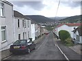
6
Fairfield Close bungalows, Cwmbach
Viewed across Cwmbach Road.
Image: © Jaggery
Taken: 19 Feb 2014
0.11 miles
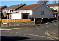
8
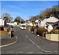
Fairfield Close, Cwmbach
Cul-de-sac on the north side on Cwmbach Road.
Image: © Jaggery
Taken: 9 Jan 2019
0.12 miles
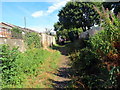
9
Llwybr yn gadael Heol Cwmbach / A footpath leaving Cwmbach Road
Cerddwyr yn gadael Heol Cwmback I ddilyn llwybr cyhoeddus.
Walkers leaving Cwmbach Road (trans. little valley) to follow a public footpath.
Image: © Alan Richards
Taken: 21 Jul 2018
0.13 miles
10
Bungalows on the corner of Fairfield Close and Well Place, Cwmbach
Originally, bungalow was used in English for a lightly-built house, with a veranda and one storey.
In current UK usage it is a convenient word for any one-storey dwelling.
Image: © Jaggery
Taken: 9 Jan 2019
0.14 miles