
IMAGES TAKEN NEAR TO
Rhodfa'r Afon, ABERDARE, CF44 0DZ
Introduction
This page details the photographs taken nearby to Rhodfa'r Afon, CF44 0DZ by members of the Geograph project.
The Geograph project started in 2005 with the aim of publishing, organising and preserving representative images for every square kilometre of Great Britain, Ireland and the Isle of Man.

There are currently over 7.5m images from over14,400 individuals and you can help contribute to the project by visiting https://www.geograph.org.uk
Image Map
Images are licensed for reuse under creativecommons.org/licenses/by-sa/2.0
Notes
- Clicking on the map will re-center to the selected point.
- The higher the marker number, the further away the image location is from the centre of the postcode.
Image Listing (26 Images Found)
Images are licensed for reuse under creativecommons.org/licenses/by-sa/2.0
Image
Details
Distance
4
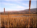
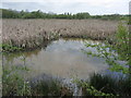
Wetland Nature Reserve in winter
This wetland is alongside the river Cynon near Aberaman
Image: © nantcoly
Taken: 13 Dec 2005
0.15 miles
5
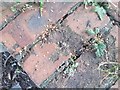
Ordnance Survey Rivet
This OS rivet can be found on the culvert NE side of the road. It marks a point 118.256m above mean sea level.
Image: © Adrian Dust
Taken: 26 Aug 2019
0.18 miles
6
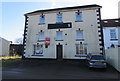
Auction board on a former pub, Cardiff Road, Aberaman
Viewed in February 2019 when only the s of The Kings name
remains on the sign seen here https://www.geograph.org.uk/photo/1846379 intact in May 2010.
UPDATE 2020. Now a wellbeing centre to tackle poverty caused by Coronavirus (COVID-19).
Image: © Jaggery
Taken: 4 Feb 2019
0.23 miles
7
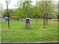
Aberaman Public Hall commemoration plinth
Located on the north side of Cardiff Road, just east of Lewis Street.
The plaque https://www.geograph.org.uk/photo/6047493 on the plinth commemorates the building formerly housing Aberaman Public Hall, Institute, Free Library and Grand Theatre. It was built on this site in 1908 and totally destroyed by fire in October 1994. The plaque ends with these words
"A wonderful building. The centre of the life of Aberaman for nearly a century".
Image: © Jaggery
Taken: 7 May 2010
0.23 miles
8
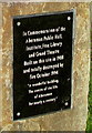
Aberaman Public Hall commemoration plaque
On this https://www.geograph.org.uk/photo/1846469 plinth.
Image: © Jaggery
Taken: 4 Feb 2019
0.23 miles
9
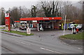
Total Garage in Cwmbach
The Canal Road garage is opposite the Well Road junction.
Image: © Jaggery
Taken: 19 Feb 2014
0.23 miles
10
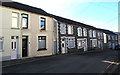
Well Place houses, Cwmbach
On the south side of Well Place. The grey railings are opposite Ynyscynon Street. https://www.geograph.org.uk/photo/3953637
Image: © Jaggery
Taken: 9 Jan 2019
0.23 miles