IMAGES TAKEN NEAR TO
Bronhaul, ABERDARE, CF44 0DP

Introduction

This page details the photographs taken nearby to Bronhaul, CF44 0DP by members of the Geograph project.

The Geograph project started in 2005 with the aim of publishing, organising and preserving representative images for every square kilometre of Great Britain, Ireland and the Isle of Man.

There are currently over 7.5m images from over14,400 individuals and you can help contribute to the project by visiting https://www.geograph.org.uk

Image Map


Images are licensed for reuse under creativecommons.org/licenses/by-sa/2.0
Notes
  • Clicking on the map will re-center to the selected point.
  • The higher the marker number, the further away the image location is from the centre of the postcode.

Image Listing (77 Images Found)

Images are licensed for reuse under creativecommons.org/licenses/by-sa/2.0
  • ...
Image
Details
Distance
1
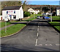
Cwmbach, viewed from the south, above Abercwmboi
Image: © Roger Cornfoot Taken: 14 Mar 2009
0.06 miles
2
Bro Teg, Cwmbach
Viewed across Canal Road. Rearden's fish & chips on the left is in Tirfounder House on the corner of Tirfounder Road and Bro Teg.
Image: © Jaggery Taken: 19 Feb 2014
0.10 miles
3
Bryn Glas, Cwmbach
Near the corner of Bridge Road, the street name sign on the right shows BRYN GLAS.
Image: © Jaggery Taken: 26 Feb 2014
0.10 miles
4
Bro Deg, Cwmbach, from the junction with Cefnpennar Rd
Image: © John Lord Taken: 3 Sep 2008
0.11 miles
5
Up Bro Deg, Cwmbach
The road named Bro Deg ascends from Canal Road. Cwmbach Chippy https://www.geograph.org.uk/photo/6023802 is on the left.
Image: © Jaggery Taken: 9 Jan 2019
0.12 miles
6
Crown Row, Cwmbach
This is the northern half of Crown Row, viewed from Tirfounder Road.
Image: © Jaggery Taken: 26 Feb 2014
0.12 miles
7
Church of St Mary Magdalene, Cwmbach
Image: © John Lord Taken: 3 Sep 2008
0.13 miles
8
Ordnance Survey Cut Mark
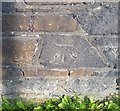
This OS cut mark can be found on the wall of the chip shop, No1 Tirfounder Road. It marks a point 124.450m above mean sea level.
Image: © Adrian Dust Taken: 26 Aug 2019
0.13 miles
9
Welsh inscription on the former Ebenezer chapel, Cwmbach
Located below the round window here https://www.geograph.org.uk/photo/6028132 on Cornerstone Church, the plaque records that the building is the 1908 renovation of Ebenezer Calvinistic Methodist Chapel built in 1864.
Image: © Jaggery Taken: 9 Jan 2019
0.13 miles
10
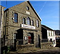
Cornerstone Church, Sion Terrace, Cwmbach
In January 2019 Cornerstone Church is part of the Elim family of churches. The inscription https://www.geograph.org.uk/photo/6028141 in Welsh on the tablet below the round window records that the building is the 1908 renovation of Ebenezer Calvinistic Methodist Chapel built in 1864.
Image: © Jaggery Taken: 9 Jan 2019
0.13 miles
  • ...