IMAGES TAKEN NEAR TO
FERNDALE, CF43 4BD

Introduction

This page details the photographs taken nearby to CF43 4BD by members of the Geograph project.

The Geograph project started in 2005 with the aim of publishing, organising and preserving representative images for every square kilometre of Great Britain, Ireland and the Isle of Man.

There are currently over 7.5m images from over14,400 individuals and you can help contribute to the project by visiting https://www.geograph.org.uk

Image Map


Images are licensed for reuse under creativecommons.org/licenses/by-sa/2.0
Notes
  • Clicking on the map will re-center to the selected point.
  • The higher the marker number, the further away the image location is from the centre of the postcode.

Image Listing (59 Images Found)

Images are licensed for reuse under creativecommons.org/licenses/by-sa/2.0
  • ...
Image
Details
Distance
1
Ordnance Survey Cut Mark
This OS cut mark can be found on the north side of Station Road. It marks a point 291.233m above mean sea level.
Image: © Adrian Dust Taken: 16 Jun 2017
0.01 miles
2
Ordnance Survey Cut Mark
This OS cut mark can be found on the corner shop, No53 Maerdy Road. It marks a point 296.936m above mean sea level.
Image: © Adrian Dust Taken: 18 Apr 2015
0.02 miles
3
A4233 Maerdy Road
Image: © Colin Pyle Taken: 4 Jan 2010
0.03 miles
4
Oxford Street
Terraced houses in Oxford Street, Maerdy.
Image: © Alan Hughes Taken: 4 May 2019
0.03 miles
5
Track towards Maerdy
Steep track leading down towards Maerdy.
Image: © Alan Hughes Taken: 4 May 2019
0.04 miles
6
Maerdy post office
Located at 24 Ceridwen Street. The post office has had the red and white logos installed since this view http://www.geograph.org.uk/photo/1663295 taken a year ago. The green bus is used on Route 902, a shuttle service (for rail passengers only) between Maerdy and Ystrad Rhondda railway station.
Image: © Jaggery Taken: 11 May 2011
0.04 miles
7
Teify House, Maerdy
Offices on Station Road (A4233) occupied by Maerdy Communities First.
Image: © Jaggery Taken: 11 May 2011
0.04 miles
8
The Hotel pub and wine bar, Maerdy
Confusingly-named premises on the corner of Ceridwen Street and School Street (the longer side).
Image: © Jaggery Taken: 11 May 2011
0.04 miles
9
Maerdy Road houses, Maerdy
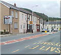
In front of a row of six houses on Maerdy Road, a sign indicates that the A4233 turns to the right ahead, and advises that the A4233 has 16% (1 in 6) gradients ahead on the way to Aberdare.
Image: © Jaggery Taken: 11 May 2011
0.04 miles
10
Maerdy Hall, Maerdy
Arguably the most famous landmark in the village, the Maerdy Workmen's Hall and Institute (originally built in 1905 on land given to the workmen of the collieries in Maerdy by landlords) is due to be demolished. The institute cost £9,000 to build and furnish and was on three floors. It had a lesser hall, billiards room and offices in the basement, with a women's reading room, men's reading room, library and refreshment room. The stairs you see to the left of the picture are supposed to be haunted by a ghost from the other side who pushed someone down the stairs. The ghost of Maerdy hall has never been seen.
Image: © Kev Griffin Taken: 16 Nov 2004
0.04 miles
  • ...