IMAGES TAKEN NEAR TO
Vivian Street, FERNDALE, CF43 3AN

Introduction

This page details the photographs taken nearby to Vivian Street, CF43 3AN by members of the Geograph project.

The Geograph project started in 2005 with the aim of publishing, organising and preserving representative images for every square kilometre of Great Britain, Ireland and the Isle of Man.

There are currently over 7.5m images from over14,400 individuals and you can help contribute to the project by visiting https://www.geograph.org.uk

Image Map


Images are licensed for reuse under creativecommons.org/licenses/by-sa/2.0
Notes
  • Clicking on the map will re-center to the selected point.
  • The higher the marker number, the further away the image location is from the centre of the postcode.

Image Listing (68 Images Found)

Images are licensed for reuse under creativecommons.org/licenses/by-sa/2.0
  • ...
Image
Details
Distance
1
Ordnance Survey Cut Mark
This OS cut mark can be found on the wall east side of Vivian Street. It marks a point 239.299m above mean sea level.
Image: © Adrian Dust Taken: 24 Jun 2017
0.07 miles
2
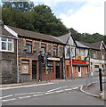
East Road, Tylorstown.
Image: © Colin Pyle Taken: 4 Jan 2010
0.07 miles
3
Jim's Garden, Tylorstown
Jim's Garden at 19 East Road is a Chinese takeaway and fish & chips shop. Next door on the left is Bailey's Home Cooked Meats.
Image: © Jaggery Taken: 20 Aug 2013
0.07 miles
4
Ordnance Survey Cut Mark
This OS cut mark can be found on No41 Brynbedw Road. It marks a point 243.959m above mean sea level.
Image: © Adrian Dust Taken: 24 Jun 2017
0.07 miles
5
Holy Trinity Church, Tylorstown
Image: © John Lord Taken: 20 Jul 2016
0.08 miles
6
Holy Trinity Church, Tylorstown
Image: © John Lord Taken: 20 Jul 2016
0.08 miles
7
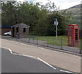
Bus shelter and phonebox, Tylorstown
Located alongside the A4233 East Road near the Edmund Street junction. This side of the road is for buses to Porth, Pontypridd and Cardiff.
Image: © Jaggery Taken: 20 Aug 2013
0.08 miles
8
Bus stop on East Road, Tylorstown
Image: © Roger Cornfoot Taken: 3 Apr 2017
0.08 miles
9
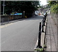
Elevated pavement, Edmund Street, Tylorstown
Looking SW towards East Road. A few tens of metres of the pavement here is above street level.
Image: © Jaggery Taken: 8 Aug 2013
0.08 miles
10
Holy Trinity Church, Tylorstown
Image: © John Lord Taken: 20 Jul 2016
0.08 miles
  • ...