IMAGES TAKEN NEAR TO
Brynbedw Road, FERNDALE, CF43 3AE

Introduction

This page details the photographs taken nearby to Brynbedw Road, CF43 3AE by members of the Geograph project.

The Geograph project started in 2005 with the aim of publishing, organising and preserving representative images for every square kilometre of Great Britain, Ireland and the Isle of Man.

There are currently over 7.5m images from over14,400 individuals and you can help contribute to the project by visiting https://www.geograph.org.uk

Image Map


Images are licensed for reuse under creativecommons.org/licenses/by-sa/2.0
Notes
  • Clicking on the map will re-center to the selected point.
  • The higher the marker number, the further away the image location is from the centre of the postcode.

Image Listing (79 Images Found)

Images are licensed for reuse under creativecommons.org/licenses/by-sa/2.0
  • ...
Image
Details
Distance
1
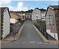
Tylorstown: Brynbedw Road
A view of Brynbedw Road, as it climbs steeply the western side of the Rhondda valley, from high up on the eastern side.
Image: © Chris Downer Taken: 18 Feb 2008
0.03 miles
2
Ordnance Survey Cut Mark
This OS cut mark can be found on No21 Brynbedw Road. It marks a point 230.179m above mean sea level.
Image: © Adrian Dust Taken: 24 Jun 2017
0.03 miles
3
Ordnance Survey Cut Mark
This OS cut mark can be found on No41 Brynbedw Road. It marks a point 243.959m above mean sea level.
Image: © Adrian Dust Taken: 24 Jun 2017
0.06 miles
4
Road from Edmund Street to East Road Tylorstown
An unnamed 55 metre long road climbs from Edmund Street up to the A4233 East Road.
Image: © Jaggery Taken: 20 Aug 2013
0.08 miles
5
Tylorstown Ex-Servicemen's Club
Image: © John Lord Taken: 20 Jul 2016
0.08 miles
6
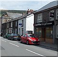
Devonalds solicitors, Tylorstown
The solicitors' office is in The Old Library, 217 East Road.
Image: © Jaggery Taken: 8 Aug 2013
0.08 miles
7
The Shot, Tylorstown
Tylorstown Ex-Servicemen's Club & Institute (The Shot) is at 228 East Road.
Image: © Jaggery Taken: 8 Aug 2013
0.08 miles
8
Pendyrus Male Choir blue plaque, Tylorstown
The Rhondda Cynon Taf County Borough Council blue plaque is on the side of Ty Ebenezer. http://www.geograph.org.uk/photo/3606528
Image: © Jaggery Taken: 8 Aug 2013
0.09 miles
9
Ty Ebenezer, Tylorstown
Viewed across East Road. Built in 1992 on the site of Ebenezer Chapel, Ty Ebenezer is managed by Rhondda Housing Association. There are 10 flats. New residents must be at least 50 years old. A blue plaque http://www.geograph.org.uk/photo/3606533 records that the Pendyrus Male Choir held its first rehearsal at Ebenezer Chapel on this site on May 24th 1924.
Image: © Jaggery Taken: 8 Aug 2013
0.09 miles
10
Ashfield House, Tylorstown
Viewed across the A4233 East Road. The name sign at the entrance shows Tylorstown On Track, a project that helps tackle truancy and exclusion through learning in Ferndale and adjoining villages such as Tylorstown.
Image: © Jaggery Taken: 20 Aug 2013
0.09 miles
  • ...