
IMAGES TAKEN NEAR TO
Station Road, TREORCHY, CF42 6UA
Introduction
This page details the photographs taken nearby to Station Road, CF42 6UA by members of the Geograph project.
The Geograph project started in 2005 with the aim of publishing, organising and preserving representative images for every square kilometre of Great Britain, Ireland and the Isle of Man.

There are currently over 7.5m images from over14,400 individuals and you can help contribute to the project by visiting https://www.geograph.org.uk
Image Map
Images are licensed for reuse under creativecommons.org/licenses/by-sa/2.0
Notes
- Clicking on the map will re-center to the selected point.
- The higher the marker number, the further away the image location is from the centre of the postcode.
Image Listing (191 Images Found)
Images are licensed for reuse under creativecommons.org/licenses/by-sa/2.0
Image
Details
Distance
1
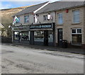
A Fish Called Rhondda, Station Road, Treorchy
In March 2020 the fish & chips shop is next door to a Rhondda Tunnel Society shop.
Image: © Jaggery
Taken: 6 Mar 2020
0.01 miles
2
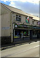
Rhondda Tunnel Society shop, Station Road, Treorchy
Viewed in March 2020. The Rhondda Tunnel is an abandoned railway tunnel extending from the Rhondda valley to the Afan valley. At 3,443 yards (3,148m) it was the third longest railway tunnel in Wales. The Rhondda Tunnel Society was formed in September 2014. Its long term aim is to raise enough money to reopen the tunnel as a cycle path. If the project is successful, it will be the longest cycle tunnel in Europe and the second longest in the world.
Image: © Jaggery
Taken: 6 Mar 2020
0.01 miles
3
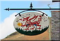
Red dragon depiction, Station Road, Treorchy
Hanging from a metal pole here https://www.geograph.org.uk/photo/6407092 the sign depicts a stylised red dragon spelling CYMRU, Welsh for WALES.
Image: © Jaggery
Taken: 6 Mar 2020
0.01 miles
4
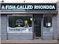
A Fish Called Rhondda
An example of the long tradition of (bad?) puns and retail premises.
Image: © Chris Andrews
Taken: 17 May 2017
0.01 miles
5
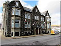
Welsh flags on a Station Road building, Treorchy
On March 6th 2020 four Welsh flags are on flagpoles on this https://www.geograph.org.uk/photo/6411806 Grade II (star) Listed building.
Image: © Jaggery
Taken: 6 Mar 2020
0.01 miles
6
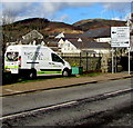
Rhondda Tunnel Society van in Treorchy
Parked at the edge of the A4061 Station Road opposite the Rhondda Tunnel Society's Treorchy shop. https://www.geograph.org.uk/photo/6407092
Image: © Jaggery
Taken: 6 Mar 2020
0.01 miles
7
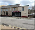
Station Cafe, Station Road, Treorchy
On the approach to Treorchy railway station.
Image: © Jaggery
Taken: 6 Mar 2020
0.01 miles
8
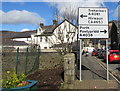
Directions sign alongside Station Road, Treorchy
Facing northbound traffic on the A4061 Station Road. Turn left ahead for the A4061 towards Treherbert and Hirwaun (A465) or right into the A4058 for Porth and Pontypridd.
Image: © Jaggery
Taken: 6 Mar 2020
0.02 miles
9
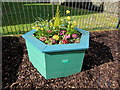
Flower tub alongside Station Road, Treorchy
Located here https://www.geograph.org.uk/photo/6407050 the tub was presented to the community by Rhondda Civic Society in 2017.
Image: © Jaggery
Taken: 6 Mar 2020
0.02 miles
10
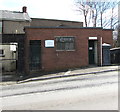
Former public toilets, Station Road, Treorchy
In March 2020, a notice on the door on the right states that these toilets are now closed - please use the new facilities attached to the library.
Image: © Jaggery
Taken: 6 Mar 2020
0.02 miles