
IMAGES TAKEN NEAR TO
Cemetery Road, TREORCHY, CF42 6TB
Introduction
This page details the photographs taken nearby to Cemetery Road, CF42 6TB by members of the Geograph project.
The Geograph project started in 2005 with the aim of publishing, organising and preserving representative images for every square kilometre of Great Britain, Ireland and the Isle of Man.

There are currently over 7.5m images from over14,400 individuals and you can help contribute to the project by visiting https://www.geograph.org.uk
Image Map
Images are licensed for reuse under creativecommons.org/licenses/by-sa/2.0
Notes
- Clicking on the map will re-center to the selected point.
- The higher the marker number, the further away the image location is from the centre of the postcode.
Image Listing (129 Images Found)
Images are licensed for reuse under creativecommons.org/licenses/by-sa/2.0
Image
Details
Distance
1
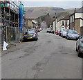
Up Cemetery Road, Treorchy
Cemetery Road ascends from the A4061 Bute Street towards Treorchy Cemetery
which opened in 1871, the first secular cemetery in the Rhondda valleys.
Image: © Jaggery
Taken: 9 Apr 2018
0.02 miles
2
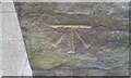
Ordnance Survey Cut Mark
This OS cut mark can be found on No7 Cemetery Road. It marks a point 170.804m above mean sea level.
Image: © Adrian Dust
Taken: 28 Apr 2017
0.03 miles
3
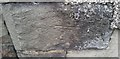
Ordnance Survey Cut Mark
This OS cut mark can be found on No87 Stuart Street. It marks a point 168.268m above mean sea level.
Image: © Adrian Dust
Taken: 28 Apr 2017
0.07 miles
4
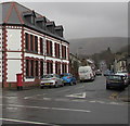
Cemetery Road, Treorchy
From the north side of the A4061 Bute Street, Cemetery Road
leads to Treorchy Cemetery about 500 metres from the camera.
The Cardiff Arms https://www.geograph.org.uk/photo/6416815 is on the left.
Image: © Jaggery
Taken: 14 Mar 2020
0.09 miles
5
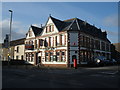
The Cardiff Arms, Bute Street, Treorchy
Image: © Roger Cornfoot
Taken: 14 Mar 2009
0.09 miles
6
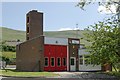
Treorchy Fire Station
Treorchy Fire Station, Bute Street, Treorchy lies up a side road from the main road along the valley through Treorchy
Image: © Kevin Hale
Taken: 5 Jun 2007
0.12 miles
7
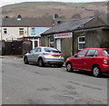
Iron Maidens in Treorchy
Ironing services business viewed across Cemetery Road from the corner of Bute Street.
Image: © Jaggery
Taken: 9 Apr 2018
0.12 miles
8
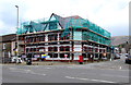
Scaffolding on a Treorchy corner
In April 2018 work is in progress on the large building on the corner of Bute Street and Cemetery Road.
The former Cardiff Arms pub, seen here https://www.geograph.org.uk/photo/2790243 in 2012, is being converted to the Bistro Cafe & Hotel.
Image: © Jaggery
Taken: 9 Apr 2018
0.12 miles
9
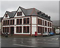
Cardiff Arms on a Treorchy corner
On the corner of the A4061 Bute Street and Cemetery Road viewed in March 2020.
Text on the wall includes BAR Bistro HOTEL.
Image: © Jaggery
Taken: 14 Mar 2020
0.12 miles
10
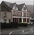
Bute Street side of the Cardiff Arms, Treorchy
The A4061 Bute Street side of the Cardiff Arms hotel, bar and bistro on the corner of Cemetery Road.
Image: © Jaggery
Taken: 14 Mar 2020
0.12 miles