
IMAGES TAKEN NEAR TO
Prospect Place, TREORCHY, CF42 6RE
Introduction
This page details the photographs taken nearby to Prospect Place, CF42 6RE by members of the Geograph project.
The Geograph project started in 2005 with the aim of publishing, organising and preserving representative images for every square kilometre of Great Britain, Ireland and the Isle of Man.

There are currently over 7.5m images from over14,400 individuals and you can help contribute to the project by visiting https://www.geograph.org.uk
Image Map
Images are licensed for reuse under creativecommons.org/licenses/by-sa/2.0
Notes
- Clicking on the map will re-center to the selected point.
- The higher the marker number, the further away the image location is from the centre of the postcode.
Image Listing (74 Images Found)
Images are licensed for reuse under creativecommons.org/licenses/by-sa/2.0
Image
Details
Distance
1
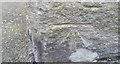
Ordnance Survey Cut Mark
This OS cut mark can be found on No65 Prospect Place. It marks a point 163.205m above mean sea level.
Image: © Adrian Dust
Taken: 7 May 2017
0.04 miles
2
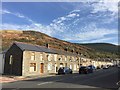
High Street, Treorchy
View along High Street, Treorchy, with Mynydd yr Eglwys in the distance.
Image: © Alan Hughes
Taken: 30 Oct 2017
0.08 miles
3
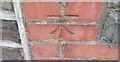
Ordnance Survey Cut Mark
This OS cut mark can be found on No55 High Street. It marks a point 157.545m above mean sea level.
Image: © Adrian Dust
Taken: 7 May 2017
0.08 miles
4
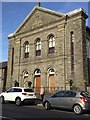
Bethlehem Chapel, Treorchy
Non-conformist Calvinist Methodist chapel in Treorchy, built in 1881.
Image: © Alan Hughes
Taken: 30 Oct 2017
0.11 miles
5
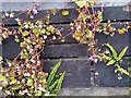
Ordnance Survey Cut Mark
This OS cut mark can be found on the SW face of the school. It marks a point 161.437m above mean sea level.
Image: © Adrian Dust
Taken: 7 May 2017
0.13 miles
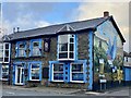
7
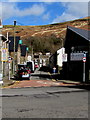
NE along Chapel Street, Treorchy
From High Street along Chapel Street towards New Chapel Street.
Image: © Jaggery
Taken: 6 Mar 2020
0.16 miles
8
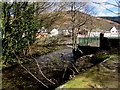
Nant Cwm-parc towards the Rhondda River, Treorchy
The stream Nant Cwm-parc flows towards its confluence with the Rhondda River on the right.
Image: © Jaggery
Taken: 6 Mar 2020
0.18 miles
9
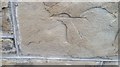
Ordnance Survey Cut Mark
This damaged OS cut mark can be found on No119 High Street. It marks a point 159.724m above mean sea level.
Image: © Adrian Dust
Taken: 7 May 2017
0.18 miles
10
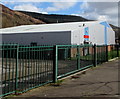
Treorchy & Cwmparc Boys & Girls Club, Treorchy
In a corrugated metal building on the south bank of the Rhondda River.
Image: © Jaggery
Taken: 6 Mar 2020
0.18 miles